

101
Almost all the lakes in Sikkim are regarded as
sacred by the local people.
Tsomgo Lake
Tsomgo Lake (also called Changu Lake or
Tsongmo Lake; etymologically ‘ Tso ’ means lake
and ‘ Mgo ’ means head , thus literally meaning
‘source of the lake’ in the Bhutia language) lying
at 3,780 m MSL, between 27° 22′ 36.68″ N–88°
45′ 28.24″ E and 27° 22′ 22.47″ N–88° 45′
58.85″ E, is situated c 40 km away from the capital Gangtok on the Gangtok–Nathula highway. It
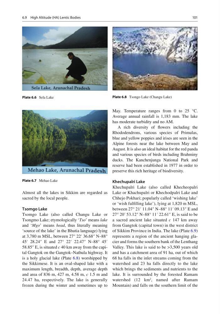
is a holy glacial lake (Plate 6.8 ) worshipped by
the Sikkimese. It is an oval-shaped lake with a
maximum length, breadth, depth, average depth
and area of 836 m, 427 m, 4.58 m, c 1.5 m and
24.47 ha, respectively. The lake is generally
frozen during the winter and sometimes up to
May. Temperature ranges from 0 to 25 °C.
Average annual rainfall is 1,183 mm. The lake
has moderate turbidity and no AM.
A rich diversity of fl owers including the
Rhododendrons, various species of Primulas,
blue and yellow poppies and irises are seen in the
Alpine forests near the lake between May and
August. It is also an ideal habitat for the red panda
and various species of birds including Brahminy
ducks. The Kanchenjunga National Park and
reserve had been established in 1977 in order to
preserve this rich heritage of biodiversity.
Khechupalri Lake
Khechupalri Lake (also called Khecheopalri
Lake or Khachupalri or Khechodpalri Lake and
Chhejo Pokhari; popularly called ‘wishing lake’
or ‘wish fulfi lling lake’), lying at 1,820 m MSL,
between 27° 21′ 11.04″ N–88° 11′ 09.13″ E and
27° 20′ 53.12″ N–88° 11′ 22.61″ E, is said to be
a sacred ancient lake situated c 147 km away
from Gangtok (capital town) in the west district
of Sikkim Province in India. The lake (Plate 6.9 )
represents a region of the ancient hanging glacier and forms the southern bank of the Lenthang
Valley. This lake is said to be >3,500 years old
and has a catchment area of 91 ha, out of which
68 ha falls in the inlet streams coming from the
watershed and 23 ha falls directly to the lake
which brings the sediments and nutrients to the
lake. It is surrounded by the forested Ramam
watershed (12 km
2 , named after Ramam
Mountain) and falls on the southern limit of the
Plate 6.6 Sela Lake
Plate 6.8 Tsongo Lake (Changu Lake)
Plate 6.7 Mehao Lake
6.9 High Altitude (HA) Lentic Bodies
Almost all the lakes in Sikkim are regarded as
sacred by the local people.
Tsomgo Lake
Tsomgo Lake (also called Changu Lake or
Tsongmo Lake; etymologically ‘ Tso ’ means lake
and ‘ Mgo ’ means head , thus literally meaning
‘source of the lake’ in the Bhutia language) lying
at 3,780 m MSL, between 27° 22′ 36.68″ N–88°
45′ 28.24″ E and 27° 22′ 22.47″ N–88° 45′
58.85″ E, is situated c 40 km away from the capital Gangtok on the Gangtok–Nathula highway. It
is a holy glacial lake (Plate 6.8 ) worshipped by
the Sikkimese. It is an oval-shaped lake with a
maximum length, breadth, depth, average depth
and area of 836 m, 427 m, 4.58 m, c 1.5 m and
24.47 ha, respectively. The lake is generally
frozen during the winter and sometimes up to
May. Temperature ranges from 0 to 25 °C.
Average annual rainfall is 1,183 mm. The lake
has moderate turbidity and no AM.
A rich diversity of fl owers including the
Rhododendrons, various species of Primulas,
blue and yellow poppies and irises are seen in the
Alpine forests near the lake between May and
August. It is also an ideal habitat for the red panda
and various species of birds including Brahminy
ducks. The Kanchenjunga National Park and
reserve had been established in 1977 in order to
preserve this rich heritage of biodiversity.
Khechupalri Lake
Khechupalri Lake (also called Khecheopalri
Lake or Khachupalri or Khechodpalri Lake and
Chhejo Pokhari; popularly called ‘wishing lake’
or ‘wish fulfi lling lake’), lying at 1,820 m MSL,
between 27° 21′ 11.04″ N–88° 11′ 09.13″ E and
27° 20′ 53.12″ N–88° 11′ 22.61″ E, is said to be
a sacred ancient lake situated c 147 km away
from Gangtok (capital town) in the west district
of Sikkim Province in India. The lake (Plate 6.9 )
represents a region of the ancient hanging glacier and forms the southern bank of the Lenthang
Valley. This lake is said to be >3,500 years old
and has a catchment area of 91 ha, out of which
68 ha falls in the inlet streams coming from the
watershed and 23 ha falls directly to the lake
which brings the sediments and nutrients to the
lake. It is surrounded by the forested Ramam
watershed (12 km
2 , named after Ramam
Mountain) and falls on the southern limit of the
Plate 6.6 Sela Lake
Plate 6.8 Tsongo Lake (Changu Lake)
Plate 6.7 Mehao Lake
6.9 High Altitude (HA) Lentic Bodies