

88
As in the Mississippi River drainage basin, growing alarm over these cumulative
effects in the Murray-Darling drainage has led to multiple management and restoration projects focused on specific portions of the river network and the drainage basin
as a whole (Arthington and Pusey 2003; Brooks and Lake 2007). In some respects,
the sense of urgency underlying these projects may be greater in Australia than in
the United States. Australia has experienced rapid population growth through immigration in recent decades and potable water supplies are severely limited by a dry
climate that is likely to experience more intense, frequent, and prolonged droughts
under a warming climate (Hughes 2003).
3.3.3 The Danube River Drainage Basin of Europe
The Danube River (Fig. 3.17) forms the premier east-west navigational corridor in
central Europe because the river flows from headwaters in Germany and eventually
enters the Black Sea via Romania (Wohl 2011). En route, the river crosses multiple
highlands and intervening alluvial basins and drains an area of 817,000 km
2
. As
might be expected, the river network has a long history of channelization
(Hohensinner et al. 2004), levee construction, flood control, construction of dams
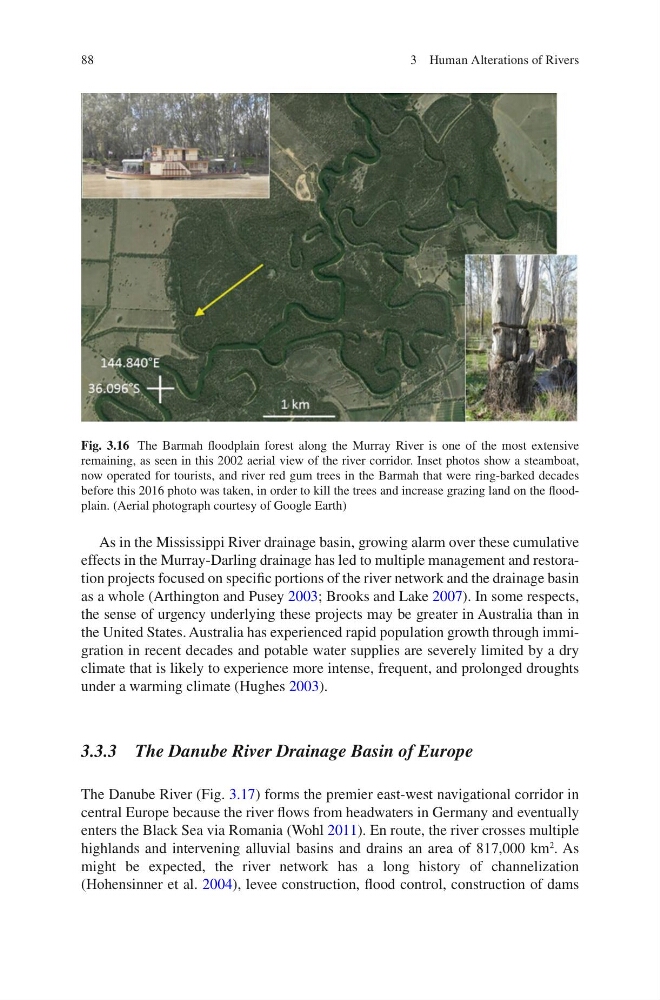
Fig. 3.16 The Barmah floodplain forest along the Murray River is one of the most extensive
remaining, as seen in this 2002 aerial view of the river corridor. Inset photos show a steamboat,
now operated for tourists, and river red gum trees in the Barmah that were ring-barked decades
before this 2016 photo was taken, in order to kill the trees and increase grazing land on the floodplain. (Aerial photograph courtesy of Google Earth)
3 Human Alterations of Rivers
As in the Mississippi River drainage basin, growing alarm over these cumulative
effects in the Murray-Darling drainage has led to multiple management and restoration projects focused on specific portions of the river network and the drainage basin
as a whole (Arthington and Pusey 2003; Brooks and Lake 2007). In some respects,
the sense of urgency underlying these projects may be greater in Australia than in
the United States. Australia has experienced rapid population growth through immigration in recent decades and potable water supplies are severely limited by a dry
climate that is likely to experience more intense, frequent, and prolonged droughts
under a warming climate (Hughes 2003).
3.3.3 The Danube River Drainage Basin of Europe
The Danube River (Fig. 3.17) forms the premier east-west navigational corridor in
central Europe because the river flows from headwaters in Germany and eventually
enters the Black Sea via Romania (Wohl 2011). En route, the river crosses multiple
highlands and intervening alluvial basins and drains an area of 817,000 km
2
. As
might be expected, the river network has a long history of channelization
(Hohensinner et al. 2004), levee construction, flood control, construction of dams
Fig. 3.16 The Barmah floodplain forest along the Murray River is one of the most extensive
remaining, as seen in this 2002 aerial view of the river corridor. Inset photos show a steamboat,
now operated for tourists, and river red gum trees in the Barmah that were ring-barked decades
before this 2016 photo was taken, in order to kill the trees and increase grazing land on the floodplain. (Aerial photograph courtesy of Google Earth)
3 Human Alterations of Rivers