

39
restrial insects, move downward into the river corridor. Water, solutes, microbes,
and macroinvertebrates move vertically between the channel and the hyporheic
zone, and water and associated solutes move vertically between the river corridor
and the ground water (Brunke and Gonser 1997).
Thinking about a river corridor or river network in the context of connectivity is
particularly useful because this viewpoint emphasizes fluxes and the processes that
maintain these fluxes. This conceptualization also promotes attention to aspects of
rivers that are more likely to be neglected, including the hyporheic zone, the floodplain, and headwater channels. The hyporheic zone may be neglected because it is
largely invisible to anyone viewing the river corridor from the ground surface or
above. The floodplain may be neglected because it is commonly viewed as somehow detached from or irrelevant to the active channel in regulatory contexts.
Headwater channels can be neglected because they are too small to support fisheries
or navigation and because they are likely to be viewed as unimportant to the functioning and integrity of river networks (e.g., in regulatory contexts, which seldom
protect very small channels; Meyer and Wallace 2001; Meyer et al. 2007; Nadeau
and Rains 2007). Each of these sometimes-neglected components of hyporheic
zone, floodplain, and headwater channels is in reality vital to the functioning of a
river ecosystem.
Connectivity is not necessarily good or bad in the context of river integrity: the
details matter. A beaver dam that reduces longitudinal connectivity also increases
lateral and vertical connectivity, creating enhanced storage of water, sediment, and
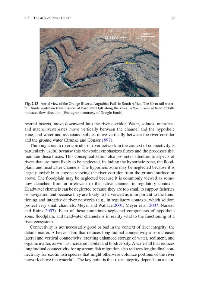
organic matter, as well as increased habitat and biodiversity. A waterfall that reduces
longitudinal connectivity for upstream fish migration also reduces longitudinal connectivity for exotic fish species that might otherwise colonize portions of the river
network above the waterfall. The key point is that river integrity depends on a natuFig. 2.13 Aerial view of the Orange River at Augrabies Falls in South Africa. The 60-m-tall waterfall limits upstream transmission of base level fall along the river. Yellow arrow at head of falls
indicates flow direction. (Photograph courtesy of Google Earth)
2.5 The 4Cs of River Health
restrial insects, move downward into the river corridor. Water, solutes, microbes,
and macroinvertebrates move vertically between the channel and the hyporheic
zone, and water and associated solutes move vertically between the river corridor
and the ground water (Brunke and Gonser 1997).
Thinking about a river corridor or river network in the context of connectivity is
particularly useful because this viewpoint emphasizes fluxes and the processes that
maintain these fluxes. This conceptualization also promotes attention to aspects of
rivers that are more likely to be neglected, including the hyporheic zone, the floodplain, and headwater channels. The hyporheic zone may be neglected because it is
largely invisible to anyone viewing the river corridor from the ground surface or
above. The floodplain may be neglected because it is commonly viewed as somehow detached from or irrelevant to the active channel in regulatory contexts.
Headwater channels can be neglected because they are too small to support fisheries
or navigation and because they are likely to be viewed as unimportant to the functioning and integrity of river networks (e.g., in regulatory contexts, which seldom
protect very small channels; Meyer and Wallace 2001; Meyer et al. 2007; Nadeau
and Rains 2007). Each of these sometimes-neglected components of hyporheic
zone, floodplain, and headwater channels is in reality vital to the functioning of a
river ecosystem.
Connectivity is not necessarily good or bad in the context of river integrity: the
details matter. A beaver dam that reduces longitudinal connectivity also increases
lateral and vertical connectivity, creating enhanced storage of water, sediment, and
organic matter, as well as increased habitat and biodiversity. A waterfall that reduces
longitudinal connectivity for upstream fish migration also reduces longitudinal connectivity for exotic fish species that might otherwise colonize portions of the river
network above the waterfall. The key point is that river integrity depends on a natuFig. 2.13 Aerial view of the Orange River at Augrabies Falls in South Africa. The 60-m-tall waterfall limits upstream transmission of base level fall along the river. Yellow arrow at head of falls
indicates flow direction. (Photograph courtesy of Google Earth)
2.5 The 4Cs of River Health