

provinces share with the former the high temperature and photic depth, but have a
narrow mixed layer depth and higher productivity. The Chilean, Easter Island and
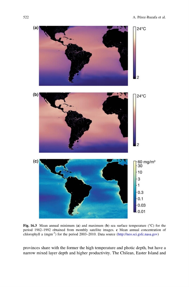
Fig. 16.3 Mean annual minimum (a) and maximum (b) sea surface temperature (°C) for the
period 1982–1992 obtained from monthly satellite images. c Mean annual concentration of
chlorophyll a (mgm
-3 ) for the period 2003–2010. Data source (http://neo.sci.gsfc.nasa.gov)
522
A. Pérez-Ruzafa et al.
narrow mixed layer depth and higher productivity. The Chilean, Easter Island and
Fig. 16.3 Mean annual minimum (a) and maximum (b) sea surface temperature (°C) for the
period 1982–1992 obtained from monthly satellite images. c Mean annual concentration of
chlorophyll a (mgm
-3 ) for the period 2003–2010. Data source (http://neo.sci.gsfc.nasa.gov)
522
A. Pérez-Ruzafa et al.