

or tsunami is likely to pollute island freshwater aquifers
(Goffredo et al., 2007; Srinivas and Nakagawa, 2008).
Infrastructure for navigation and weather
monitoring
The GBR is the largest system of coral reefs in the world
and adjoins a well-populated coastal region, exporting
large quantities of minerals and agricultural products.
Many ships need to navigate its waters and provision of
navigation aids commenced in the middle of the nineteenth century.
Raine Island is the largest cay on the outer reefs of the
GBR, located at the entrance to a passage from the Coral
Sea to inner GBR waters. The earliest beacon on the
GBR was constructed on this island by British sailors
and convicts from New South Wales in 1844 using local
cay rock (Figure 7). Subsequently, as steamships replaced
sailing ships, the sheltered inner passage became the preferred course for shipping, initially sailing in daylight
hours and anchoring at night. More navigation aids were
needed – unlit wooden beacons and even coconut palms
planted on coral cays. As pressure developed for shorter
passage times, together with increasing loss of life from
vessels hitting reefs, manned lightships and lighthouses
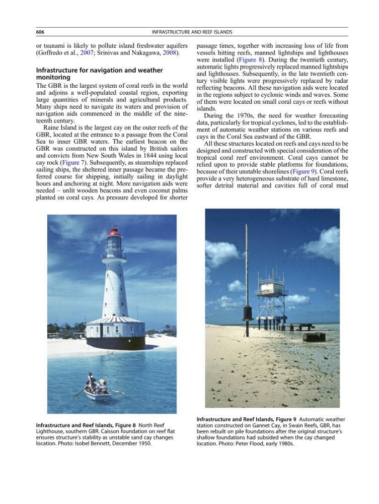
were installed (Figure 8). During the twentieth century,
automatic lights progressively replaced manned lightships
and lighthouses. Subsequently, in the late twentieth century visible lights were progressively replaced by radar
reflecting beacons. All these navigation aids were located
in the regions subject to cyclonic winds and waves. Some
of them were located on small coral cays or reefs without
islands.
During the 1970s, the need for weather forecasting
data, particularly for tropical cyclones, led to the establishment of automatic weather stations on various reefs and
cays in the Coral Sea eastward of the GBR.
All these structures located on reefs and cays need to be
designed and constructed with special consideration of the
tropical coral reef environment. Coral cays cannot be
relied upon to provide stable platforms for foundations,
because of their unstable shorelines (Figure 9). Coral reefs
provide a very heterogeneous substrate of hard limestone,
softer detrital material and cavities full of coral mud
Infrastructure and Reef Islands, Figure 8 North Reef
Lighthouse, southern GBR. Caisson foundation on reef flat
ensures structure’s stability as unstable sand cay changes
location. Photo: Isobel Bennett, December 1950.
Infrastructure and Reef Islands, Figure 9 Automatic weather
station constructed on Gannet Cay, in Swain Reefs, GBR, has
been rebuilt on pile foundations after the original structure’s
shallow foundations had subsided when the cay changed
location. Photo: Peter Flood, early 1980s.
606
INFRASTRUCTURE AND REEF ISLANDS