

Recent Satellite Studies
13
(1971) illustrates an occasion when 4 major cyclones were present simultaneously in the
southern Indian Ocean.
The role of the tropical cloud cluster in vertically transporting heat, mass and
momentum and its significance for the atmospheric global circulation is to be studied as
a matter of priority in the Global Atmospheric Research Project (GARP), which is being
organized jointly by the World Meteorological Organisation and the International
Union of Geodesy and Geophysics.
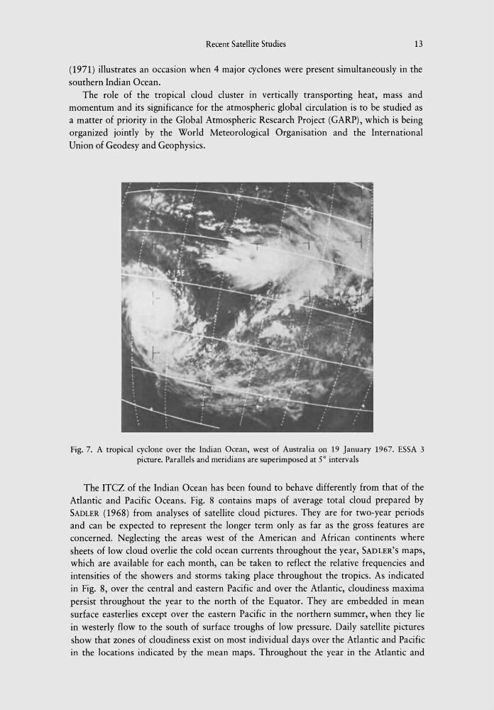
Fig. 7. A tropical cyclone over the Indian Ocean, west of Australia on 19 January 1967. ESSA 3
picture. Parallels and meridians are superimposed at 5° intervals
The ITCZ of the Indian Ocean has been found to behave differently from that of the
Atlantic and Pacific Oceans. Fig. 8 contains maps of average total cloud prepared by
SADLER (1968) from analyses of satellite cloud pictures. They are for two-year periods
and can be expected to represent the longer term only as far as the gross features are
concerned. Neglecting the areas west of the American and African continents where
sheets of low cloud overlie the cold ocean currents throughout the year, SADLER'S maps,
which are available for each month, can be taken to reflect the relative frequencies and
intensities of the showers and storms taking place throughout the tropics. As indicated
in Fig. 8, over the central and eastern Pacific and over the Atlantic, cloudiness maxima
persist throughout the year to the north of the Equator. They are embedded in mean
surface easterlies except over the eastern Pacific in the northern summer, when they lie
in westerly flow to the south of surface troughs of low pressure. Daily satellite pictures
show that zones of cloudiness exist on most individual days over the Atlantic and Pacific
in the locations indicated by the mean maps. Throughout the year in the Atlantic and
13
(1971) illustrates an occasion when 4 major cyclones were present simultaneously in the
southern Indian Ocean.
The role of the tropical cloud cluster in vertically transporting heat, mass and
momentum and its significance for the atmospheric global circulation is to be studied as
a matter of priority in the Global Atmospheric Research Project (GARP), which is being
organized jointly by the World Meteorological Organisation and the International
Union of Geodesy and Geophysics.
Fig. 7. A tropical cyclone over the Indian Ocean, west of Australia on 19 January 1967. ESSA 3
picture. Parallels and meridians are superimposed at 5° intervals
The ITCZ of the Indian Ocean has been found to behave differently from that of the
Atlantic and Pacific Oceans. Fig. 8 contains maps of average total cloud prepared by
SADLER (1968) from analyses of satellite cloud pictures. They are for two-year periods
and can be expected to represent the longer term only as far as the gross features are
concerned. Neglecting the areas west of the American and African continents where
sheets of low cloud overlie the cold ocean currents throughout the year, SADLER'S maps,
which are available for each month, can be taken to reflect the relative frequencies and
intensities of the showers and storms taking place throughout the tropics. As indicated
in Fig. 8, over the central and eastern Pacific and over the Atlantic, cloudiness maxima
persist throughout the year to the north of the Equator. They are embedded in mean
surface easterlies except over the eastern Pacific in the northern summer, when they lie
in westerly flow to the south of surface troughs of low pressure. Daily satellite pictures
show that zones of cloudiness exist on most individual days over the Atlantic and Pacific
in the locations indicated by the mean maps. Throughout the year in the Atlantic and