

730
that water flow through the openings caused the erosion. Erosion of the old dike had
been ongoing and persistent for years. The profiles for Line 15 (Fig. 21.15) show
where the dike was in 2006, where the opening floor was in 2010, and that the only
change to the opening floor from 2010 to 2012 was some headward erosion caused,
most likely, by water draining over the sill and back into the Bay on the ebb tide.
The other relevant observation that may be drawn from Fig. 21.15 is that where
marsh still existed in front of the old dike, the dike itself was not eroding. The
profiles for Line 8 (in the NW cell) show that the margin of the marsh in front of the
dike had been (and is) eroding over time (as is the case for the reference marshes
that flank the restoration cells), but that the dike profile itself has changed little since
2006. Material that appeared to have been added to the dike face in this location in
2010 during construction of the openings remained in place. The profiles for Line
10 (in the SE cell) illustrate the same situation – where marsh is present in front of
the dike, the dike is protected from erosion.
Qualitative observations since 2012 confirm that erosion of the seaward edge of
both the old dike and the reference salt marshes that flank the restoration cells is
continuing. In many locations, the old dike is no longer high enough to hold back
seawater from the Bay at spring high tide. There are now many more openings in the
old dike than those constructed as part of the project, including new openings at the
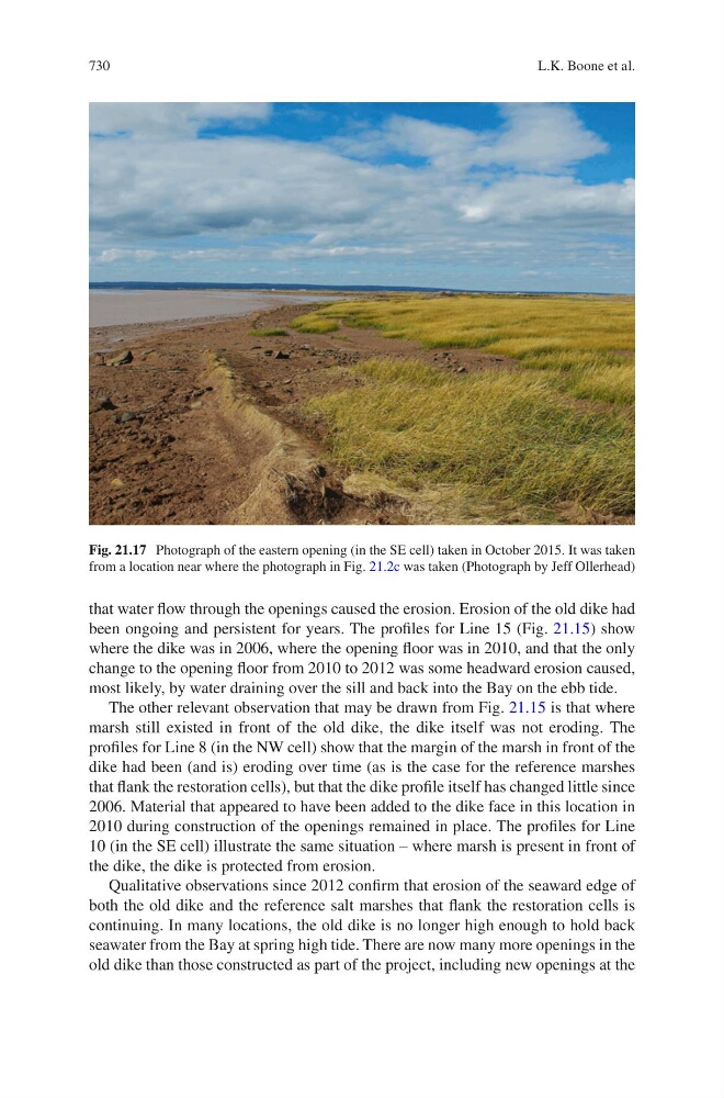
Fig. 21.17 Photograph of the eastern opening (in the SE cell) taken in October 2015. It was taken
from a location near where the photograph in Fig. 21.2c was taken (Photograph by Jeff Ollerhead)
L.K. Boone et al.