

724
destroyed any RSET stations, we also used RTK DGPS to take a measurement of
surface elevation at each plot each year.
It quickly became apparent that both types of measurement (cryocoring and RTK
DGPS) needed to be used to determine amount of sediment deposited, because of
standing water and/or the thickness of mud deposited over some locations. It was
only possible to core through 30–45 cm of mud with the equipment available, and
at some locations more than 50 cm of mud was deposited in the first year.
Furthermore, some locations could not be measured in the first year because the
mud surface was too unconsolidated and unstable to walk on. In 2012 (2 years postbreach) and onwards, all plots were visited. The correlation between the thickness
of sediment deposited as measured by the two methods was assessed for each year
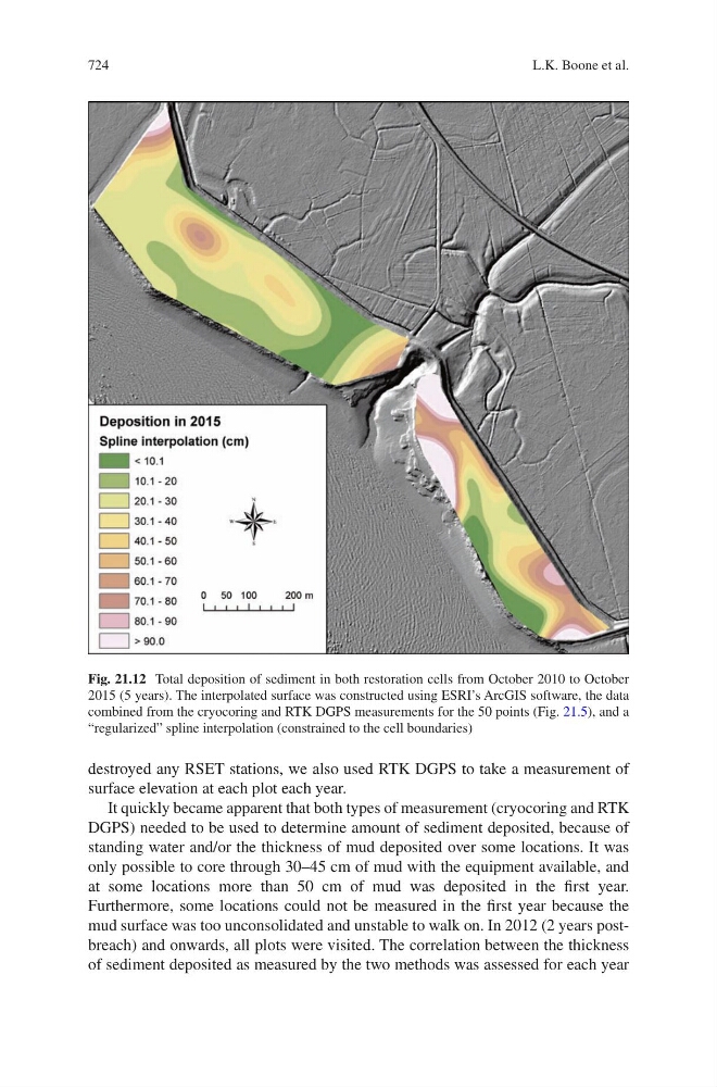
Fig. 21.12 Total deposition of sediment in both restoration cells from October 2010 to October
2015 (5 years). The interpolated surface was constructed using ESRI’s ArcGIS software, the data
combined from the cryocoring and RTK DGPS measurements for the 50 points (Fig. 21.5), and a
“regularized” spline interpolation (constrained to the cell boundaries)
L.K. Boone et al.