

641
20.2.4 Laguna Estuarine Complex
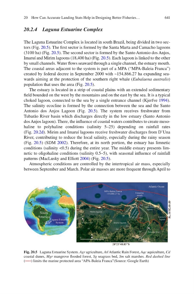
The Laguna Estuarine Complex is located in south Brazil, being divided in two sectors (Fig. 20.5). The first sector is formed by the Santa Marta and Camacho lagoons
(3100 ha) (Fig. 20.5). The second sector is formed by the Santo Antonio dos Anjos,
Imaruí and Mirim lagoons (18,400 ha) (Fig. 20.5). Each lagoon is linked to the other
by small channels. Water flows seaward through a single channel, the estuary mouth.
The coastal areas adjacent to the system is part of a MPA (“MPA-Baleia Franca”)
created by federal decree in September 2000 with ~154,866.27 ha expanding seawards aiming at the protection of the southern right whale (Eubalaena australis)
population that uses the area (Fig. 20.5).
The estuary is located in a strip of coastal plains with an extended sedimentary
field bounded on the west by the mountains and on the east by the sea. It is a typical
choked lagoon, connected to the sea by a single entrance channel (Kjerfve 1994).
The salinity ecocline is formed by the connection between the sea and the Santo
Antonio dos Anjos Lagoon (Fig. 20.5). The system receives freshwater from
Tubarão River basin which discharges directly in the low estuary (Santo Antonio
dos Anjos lagoon). There, the influence of coastal waters contributes to create mesohaline to polyhaline conditions (salinity 5–25) depending on rainfall rates
(Fig. 20.2d). Mirim and Imaruí lagoons receive freshwater discharges from D’Una
River, contributing to reduce the local salinity, especially during the rainy season
(Fig. 20.5) (SDM 2002). Therefore, at its north portion, the estuary has limnetic
conditions (salinity <0.5) during the entire year. The middle estuary presents limnetic to oligohaline conditions (salinity 0.5–5), with seasonal influence of rainfall
patterns (MacLusky and Elliott 2004) (Fig. 20.5).
Atmospheric conditions are controlled by the intertropical air mass, especially
between September and March. Polar air masses are more frequent through April to
Fig. 20.5 Laguna Estuarine System. Agr agriculture, Atl Atlantic Rain Forest, Aqc aquiculture, Cd
coastal dunes, Mgr mangrove flooded forest, Sg seagrass bed, Sm salt marshes. Red dashed line
(----) limits the marine protected area “APA-Baleia Franca”(Source: Google Earth)
20 How Can Accurate Landing Stats Help in Designing Better Fisheries…