

620
(xi) Erosion/r accretion: Multi- temporal high resolution satellite data have been
used to map erosion/accretion
(xii) Sedimentation pattern in waterways: Pre and post monsoon satellite data
and field observations have been used to map the sedimentation along the rivers, lagoons, creeks and channels and other open water bodies.
As Pichhavaram mangrove is a protected area, it has no influence of anthropogenic pressure, sedimentation and dredging inside the wetland area, the indicator
values are considered as 100 throughout the wetland grids. Similarly, natural regeneration is noticed in all mangroves area after monsoon period. So this indicator
value is also considered as 100 for entire wetland.
0
1Kilometers
N
Bay of Bengal
Percent of waterspread
< 1% water spread area
1 - 5
5 - 10
10 - 20
> 20%
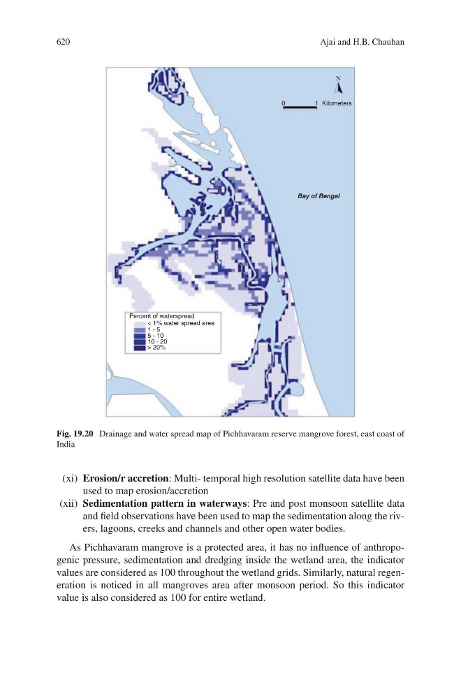
Fig. 19.20 Drainage and water spread map of Pichhavaram reserve mangrove forest, east coast of
India
Ajai and H.B. Chauhan