

619
(vii) Stand size/ fragmentation: Change in stand size/fragmentation in mangrove
vegetation have been mapped using multi-temporal temporal satellite data
(viii) Change in vegetation pattern: Changes such as mangrove to mangrove,
mangrove to halophyte, mangrove to non-mangroves were mapped using
multi-temporal satellite data.
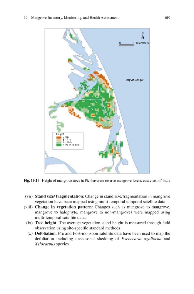
(ix) Tree height: The average vegetation stand height is measured through field
observation using site-specific standard methods.
(x) Defoliation: Pre and Post-monsoon satellite data have been used to map the
defoliation including unseasonal shedding of Excoecaria agallocha and
Xylocarpus species
0
1Kilometers
N
Bay of Bengal
Height
< 3m
3 - 7 m
7 - 10m
> 10 m height
Fig. 19.19 Height of mangrove trees in Pichhavaram reserve mangrove forest, east coast of India
19 Mangrove Inventory, Monitoring, and Health Assessment