

617
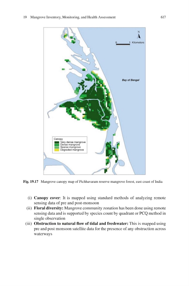
(i) Canopy cover: It is mapped using standard methods of analyzing remote
sensing data of pre and post-monsoon
(ii) Floral diversity: Mangrove community zonation has been done using remote
sensing data and is supported by species count by quadrant or PCQ method in
single observation
(iii) Obstruction to natural flow of tidal and freshwater: This is mapped using
pre and post monsoon satellite data for the presence of any obstruction across
waterways
0
1Kilometers
N
Bay of Bengal
Canopy
Very dense mangrove
Dense mangrove
Sparse mangrove
Degraded mangrove
Fig. 19.17 Mangrove canopy map of Pichhavaram reserve mangrove forest, east coast of India
19 Mangrove Inventory, Monitoring, and Health Assessment