

362
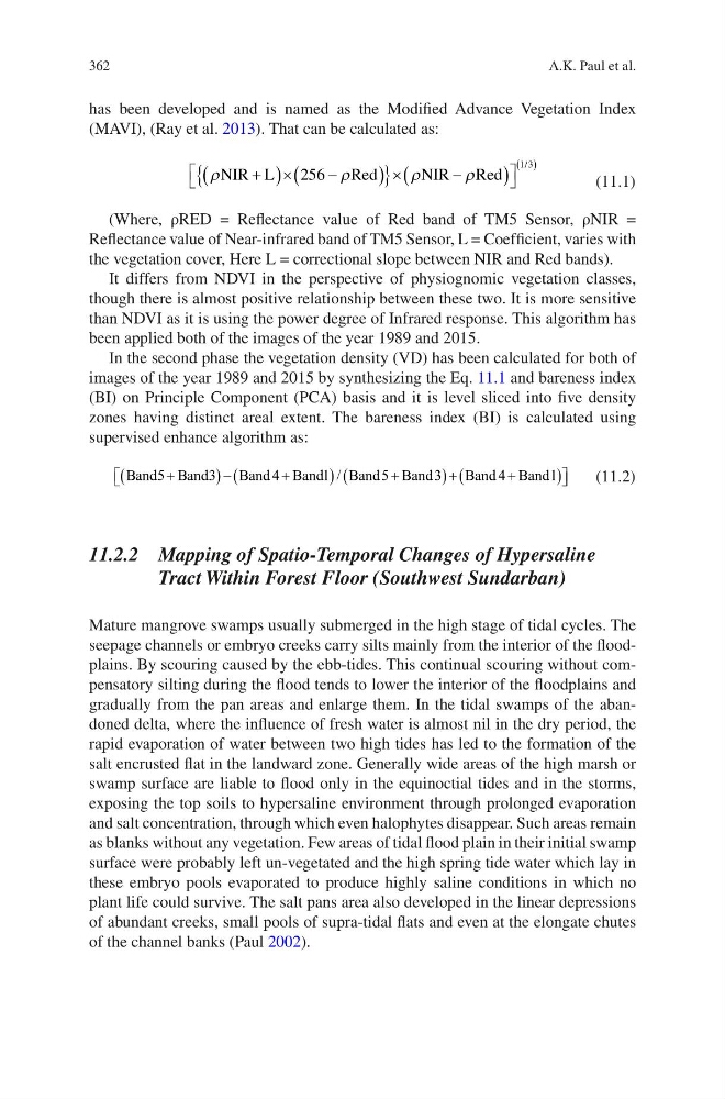
has been developed and is named as the Modified Advance Vegetation Index
(MAVI), (Ray et al. 2013). That can be calculated as:
r
r
r
r
NIR L
Red
NIR
Red
+
(
)´
-
(
)
{
} ´
-
(
)
é
ë
ù
û
( )
256
1 3
/
(11.1)
(Where, ρRED = Reflectance value of Red band of TM5 Sensor, ρNIR =
Reflectance value of Near-infrared band of TM5 Sensor, L = Coefficient, varies with
the vegetation cover, Here L = correctional slope between NIR and Red bands).
It differs from NDVI in the perspective of physiognomic vegetation classes,
though there is almost positive relationship between these two. It is more sensitive
than NDVI as it is using the power degree of Infrared response. This algorithm has
been applied both of the images of the year 1989 and 2015.
In the second phase the vegetation density (VD) has been calculated for both of
images of the year 1989 and 2015 by synthesizing the Eq. 11.1 and bareness index
(BI) on Principle Component (PCA) basis and it is level sliced into five density
zones having distinct areal extent. The bareness index (BI) is calculated using
supervised enhance algorithm as:
Band Band
Band
Band
Band Band
Band
Band
5
3
4
1
5
3
4
1
+
-
+
+
+
+
(
)(
)(
)(
)
é ë
ù
/
û û
(11.2)
11.2.2 Mapping of Spatio-Temporal Changes of Hypersaline
Tract Within Forest Floor (Southwest Sundarban)
Mature mangrove swamps usually submerged in the high stage of tidal cycles. The
seepage channels or embryo creeks carry silts mainly from the interior of the floodplains. By scouring caused by the ebb-tides. This continual scouring without compensatory silting during the flood tends to lower the interior of the floodplains and
gradually from the pan areas and enlarge them. In the tidal swamps of the abandoned delta, where the influence of fresh water is almost nil in the dry period, the
rapid evaporation of water between two high tides has led to the formation of the
salt encrusted flat in the landward zone. Generally wide areas of the high marsh or
swamp surface are liable to flood only in the equinoctial tides and in the storms,
exposing the top soils to hypersaline environment through prolonged evaporation
and salt concentration, through which even halophytes disappear. Such areas remain
as blanks without any vegetation. Few areas of tidal flood plain in their initial swamp
surface were probably left un-vegetated and the high spring tide water which lay in
these embryo pools evaporated to produce highly saline conditions in which no
plant life could survive. The salt pans area also developed in the linear depressions
of abundant creeks, small pools of supra-tidal flats and even at the elongate chutes
of the channel banks (Paul 2002).
A.K. Paul et al.
has been developed and is named as the Modified Advance Vegetation Index
(MAVI), (Ray et al. 2013). That can be calculated as:
r
r
r
r
NIR L
Red
NIR
Red
+
(
)´
-
(
)
{
} ´
-
(
)
é
ë
ù
û
( )
256
1 3
/
(11.1)
(Where, ρRED = Reflectance value of Red band of TM5 Sensor, ρNIR =
Reflectance value of Near-infrared band of TM5 Sensor, L = Coefficient, varies with
the vegetation cover, Here L = correctional slope between NIR and Red bands).
It differs from NDVI in the perspective of physiognomic vegetation classes,
though there is almost positive relationship between these two. It is more sensitive
than NDVI as it is using the power degree of Infrared response. This algorithm has
been applied both of the images of the year 1989 and 2015.
In the second phase the vegetation density (VD) has been calculated for both of
images of the year 1989 and 2015 by synthesizing the Eq. 11.1 and bareness index
(BI) on Principle Component (PCA) basis and it is level sliced into five density
zones having distinct areal extent. The bareness index (BI) is calculated using
supervised enhance algorithm as:
Band Band
Band
Band
Band Band
Band
Band
5
3
4
1
5
3
4
1
+
-
+
+
+
+
(
)(
)(
)(
)
é ë
ù
/
û û
(11.2)
11.2.2 Mapping of Spatio-Temporal Changes of Hypersaline
Tract Within Forest Floor (Southwest Sundarban)
Mature mangrove swamps usually submerged in the high stage of tidal cycles. The
seepage channels or embryo creeks carry silts mainly from the interior of the floodplains. By scouring caused by the ebb-tides. This continual scouring without compensatory silting during the flood tends to lower the interior of the floodplains and
gradually from the pan areas and enlarge them. In the tidal swamps of the abandoned delta, where the influence of fresh water is almost nil in the dry period, the
rapid evaporation of water between two high tides has led to the formation of the
salt encrusted flat in the landward zone. Generally wide areas of the high marsh or
swamp surface are liable to flood only in the equinoctial tides and in the storms,
exposing the top soils to hypersaline environment through prolonged evaporation
and salt concentration, through which even halophytes disappear. Such areas remain
as blanks without any vegetation. Few areas of tidal flood plain in their initial swamp
surface were probably left un-vegetated and the high spring tide water which lay in
these embryo pools evaporated to produce highly saline conditions in which no
plant life could survive. The salt pans area also developed in the linear depressions
of abundant creeks, small pools of supra-tidal flats and even at the elongate chutes
of the channel banks (Paul 2002).
A.K. Paul et al.