

219
This joint estuary is considered as one of the most heavy metal-polluted systems
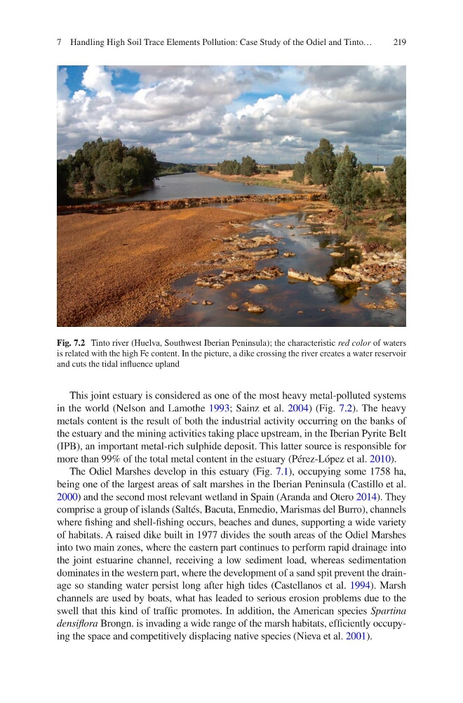
in the world (Nelson and Lamothe 1993; Sainz et al. 2004) (Fig. 7.2). The heavy
metals content is the result of both the industrial activity occurring on the banks of
the estuary and the mining activities taking place upstream, in the Iberian Pyrite Belt
(IPB), an important metal-rich sulphide deposit. This latter source is responsible for
more than 99% of the total metal content in the estuary (Pérez-López et al. 2010).
The Odiel Marshes develop in this estuary (Fig. 7.1), occupying some 1758 ha,
being one of the largest areas of salt marshes in the Iberian Peninsula (Castillo et al.
2000) and the second most relevant wetland in Spain (Aranda and Otero 2014). They
comprise a group of islands (Saltés, Bacuta, Enmedio, Marismas del Burro), channels
where fishing and shell-fishing occurs, beaches and dunes, supporting a wide variety
of habitats. A raised dike built in 1977 divides the south areas of the Odiel Marshes
into two main zones, where the eastern part continues to perform rapid drainage into
the joint estuarine channel, receiving a low sediment load, whereas sedimentation
dominates in the western part, where the development of a sand spit prevent the drainage so standing water persist long after high tides (Castellanos et al. 1994). Marsh
channels are used by boats, what has leaded to serious erosion problems due to the
swell that this kind of traffic promotes. In addition, the American species Spartina
densiflora Brongn. is invading a wide range of the marsh habitats, efficiently occupying the space and competitively displacing native species (Nieva et al. 2001).
Fig. 7.2 Tinto river (Huelva, Southwest Iberian Peninsula); the characteristic red color of waters
is related with the high Fe content. In the picture, a dike crossing the river creates a water reservoir
and cuts the tidal influence upland
7 Handling High Soil Trace Elements Pollution: Case Study of the Odiel and Tinto…
This joint estuary is considered as one of the most heavy metal-polluted systems
in the world (Nelson and Lamothe 1993; Sainz et al. 2004) (Fig. 7.2). The heavy
metals content is the result of both the industrial activity occurring on the banks of
the estuary and the mining activities taking place upstream, in the Iberian Pyrite Belt
(IPB), an important metal-rich sulphide deposit. This latter source is responsible for
more than 99% of the total metal content in the estuary (Pérez-López et al. 2010).
The Odiel Marshes develop in this estuary (Fig. 7.1), occupying some 1758 ha,
being one of the largest areas of salt marshes in the Iberian Peninsula (Castillo et al.
2000) and the second most relevant wetland in Spain (Aranda and Otero 2014). They
comprise a group of islands (Saltés, Bacuta, Enmedio, Marismas del Burro), channels
where fishing and shell-fishing occurs, beaches and dunes, supporting a wide variety
of habitats. A raised dike built in 1977 divides the south areas of the Odiel Marshes
into two main zones, where the eastern part continues to perform rapid drainage into
the joint estuarine channel, receiving a low sediment load, whereas sedimentation
dominates in the western part, where the development of a sand spit prevent the drainage so standing water persist long after high tides (Castellanos et al. 1994). Marsh
channels are used by boats, what has leaded to serious erosion problems due to the
swell that this kind of traffic promotes. In addition, the American species Spartina
densiflora Brongn. is invading a wide range of the marsh habitats, efficiently occupying the space and competitively displacing native species (Nieva et al. 2001).
Fig. 7.2 Tinto river (Huelva, Southwest Iberian Peninsula); the characteristic red color of waters
is related with the high Fe content. In the picture, a dike crossing the river creates a water reservoir
and cuts the tidal influence upland
7 Handling High Soil Trace Elements Pollution: Case Study of the Odiel and Tinto…