

218
result, all these considerations make difficult the management of specific areas by
standardized actions, and imply that each case may be particularly considered, beyond
general common guidelines for ecological restoration.
7.2 Salt Marshes Developed in One of the Most Polluted
Estuaries in the World
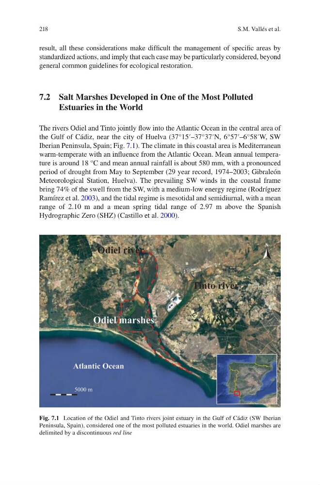
The rivers Odiel and Tinto jointly flow into the Atlantic Ocean in the central area of
the Gulf of Cádiz, near the city of Huelva (37°15′–37°37′N, 6°57′–6°58′W, SW
Iberian Peninsula, Spain; Fig. 7.1). The climate in this coastal area is Mediterranean
warm-temperate with an influence from the Atlantic Ocean. Mean annual temperature is around 18 °C and mean annual rainfall is about 580 mm, with a pronounced
period of drought from May to September (29 year record, 1974–2003; Gibraleón
Meteorological Station, Huelva). The prevailing SW winds in the coastal frame
bring 74% of the swell from the SW, with a medium-low energy regime (Rodríguez
Ramírez et al. 2003), and the tidal regime is mesotidal and semidiurnal, with a mean
range of 2.10 m and a mean spring tidal range of 2.97 m above the Spanish
Hydrographic Zero (SHZ) (Castillo et al. 2000).
Fig. 7.1 Location of the Odiel and Tinto rivers joint estuary in the Gulf of Cádiz (SW Iberian
Peninsula, Spain), considered one of the most polluted estuaries in the world. Odiel marshes are
delimited by a discontinuous red line
S.M. Vallés et al.
result, all these considerations make difficult the management of specific areas by
standardized actions, and imply that each case may be particularly considered, beyond
general common guidelines for ecological restoration.
7.2 Salt Marshes Developed in One of the Most Polluted
Estuaries in the World
The rivers Odiel and Tinto jointly flow into the Atlantic Ocean in the central area of
the Gulf of Cádiz, near the city of Huelva (37°15′–37°37′N, 6°57′–6°58′W, SW
Iberian Peninsula, Spain; Fig. 7.1). The climate in this coastal area is Mediterranean
warm-temperate with an influence from the Atlantic Ocean. Mean annual temperature is around 18 °C and mean annual rainfall is about 580 mm, with a pronounced
period of drought from May to September (29 year record, 1974–2003; Gibraleón
Meteorological Station, Huelva). The prevailing SW winds in the coastal frame
bring 74% of the swell from the SW, with a medium-low energy regime (Rodríguez
Ramírez et al. 2003), and the tidal regime is mesotidal and semidiurnal, with a mean
range of 2.10 m and a mean spring tidal range of 2.97 m above the Spanish
Hydrographic Zero (SHZ) (Castillo et al. 2000).
Fig. 7.1 Location of the Odiel and Tinto rivers joint estuary in the Gulf of Cádiz (SW Iberian
Peninsula, Spain), considered one of the most polluted estuaries in the world. Odiel marshes are
delimited by a discontinuous red line
S.M. Vallés et al.