

140
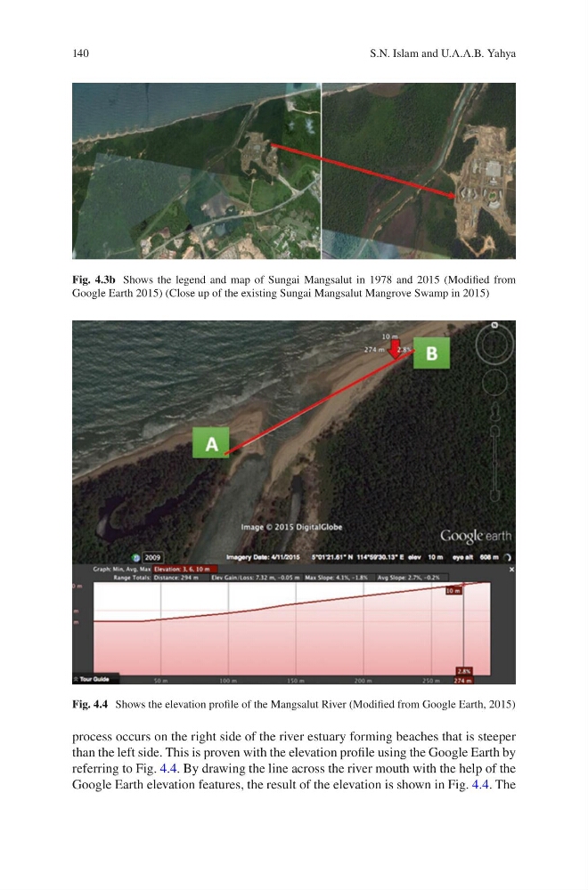
process occurs on the right side of the river estuary forming beaches that is steeper
than the left side. This is proven with the elevation profile using the Google Earth by
referring to Fig. 4.4. By drawing the line across the river mouth with the help of the
Google Earth elevation features, the result of the elevation is shown in Fig. 4.4. The
Fig. 4.3b Shows the legend and map of Sungai Mangsalut in 1978 and 2015 (Modified from
Google Earth 2015) (Close up of the existing Sungai Mangsalut Mangrove Swamp in 2015)
Fig. 4.4 Shows the elevation profile of the Mangsalut River (Modified from Google Earth, 2015)
S.N. Islam and U.A.A.B. Yahya
process occurs on the right side of the river estuary forming beaches that is steeper
than the left side. This is proven with the elevation profile using the Google Earth by
referring to Fig. 4.4. By drawing the line across the river mouth with the help of the
Google Earth elevation features, the result of the elevation is shown in Fig. 4.4. The
Fig. 4.3b Shows the legend and map of Sungai Mangsalut in 1978 and 2015 (Modified from
Google Earth 2015) (Close up of the existing Sungai Mangsalut Mangrove Swamp in 2015)
Fig. 4.4 Shows the elevation profile of the Mangsalut River (Modified from Google Earth, 2015)
S.N. Islam and U.A.A.B. Yahya