

SEDLOB and PATLOB
133
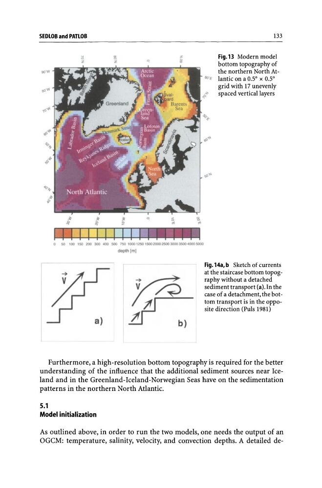
Fig.13 Modern model
bottom topography of
the northern North At8(l'e lantic on a 0.5° x 0.5°
grid with 17 unevenly
~~
spaced vertical layers
o 50 100 150 200 300 ' 00 500 750 1000 1250 15002000250030003500'0005000
depth 1m)
Fig. 14a, b Sketch of currents
at the staircase bottom topography without a detached
sediment transport (a). In the
case of a detachment, the bottom transport is in the opposite direction (Puis 1981)
Furthermore, a high-resolution bottom topography is required for the better
understanding of the influence that the additional sediment sources near Iceland and in the Greenland-Iceland-Norwegian Seas have on the sedimentation
patterns in the northern North Atlantic.
5.1
Model initialization
As outlined above, in order to run the two models, one needs the output of an
OGCM: temperature, salinity, velocity, and convection depths. A detailed de-
133
Fig.13 Modern model
bottom topography of
the northern North At8(l'e lantic on a 0.5° x 0.5°
grid with 17 unevenly
~~
spaced vertical layers
o 50 100 150 200 300 ' 00 500 750 1000 1250 15002000250030003500'0005000
depth 1m)
Fig. 14a, b Sketch of currents
at the staircase bottom topography without a detached
sediment transport (a). In the
case of a detachment, the bottom transport is in the opposite direction (Puis 1981)
Furthermore, a high-resolution bottom topography is required for the better
understanding of the influence that the additional sediment sources near Iceland and in the Greenland-Iceland-Norwegian Seas have on the sedimentation
patterns in the northern North Atlantic.
5.1
Model initialization
As outlined above, in order to run the two models, one needs the output of an
OGCM: temperature, salinity, velocity, and convection depths. A detailed de-