

561
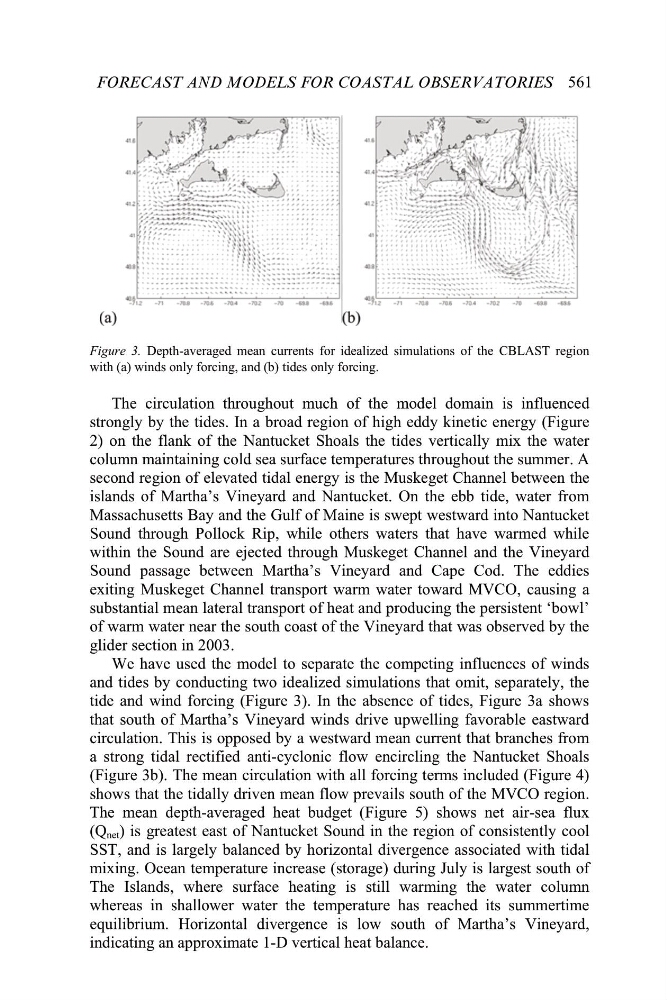
Figure 3. Depth-averaged mean currents for idealized simulations of the CBLAST region
with (a) winds only forcing, and (b) tides only forcing.
The circulation throughout much of the model domain is influenced
strongly by the tides. In a broad region of high eddy kinetic energy (Figure
2) on the flank of the Nantucket Shoals the tides vertically mix the water
column maintaining cold sea surface temperatures throughout the summer. A
second region of elevated tidal energy is the Muskeget Channel between the
islands of Martha’s Vineyard and Nantucket. On the ebb tide, water from
Massachusetts Bay and the Gulf of Maine is swept westward into Nantucket
Sound through Pollock Rip, while others waters that have warmed while
within the Sound are ejected through Muskeget Channel and the Vineyard
Sound passage between Martha’s Vineyard and Cape Cod. The eddies
exiting Muskeget Channel transport warm water toward MVCO, causing a
substantial mean lateral transport of heat and producing the persistent ‘bowl’
of warm water near the south coast of the Vineyard that was observed by the
glider section in 2003.
We have used the model to separate the competing influences of winds
and tides by conducting two idealized simulations that omit, separately, the
tide and wind forcing (Figure 3). In the absence of tides, Figure 3a shows
that south of Martha’s Vineyard winds drive upwelling favorable eastward
circulation. This is opposed by a westward mean current that branches from
a strong tidal rectified anti-cyclonic flow encircling the Nantucket Shoals
(Figure 3b). The mean circulation with all forcing terms included (Figure 4)
shows that the tidally driven mean flow prevails south of the MVCO region.
The mean depth-averaged heat budget (Figure 5) shows net air-sea flux
net ) is greatest east of Nantucket Sound in the region of consistently cool
SST, and is largely balanced by horizontal divergence associated with tidal
mixing. Ocean temperature increase (storage) during July is largest south of
The Islands, where surface heating is still warming the water column
whereas in shallower water the temperature has reached its summertime
equilibrium. Horizontal divergence is low south of Martha’s Vineyard,
indicating an approximate 1-D vertical heat balance.
FORECAST AND MODELS FOR COASTAL OBSERVATORIES
(Q