

3.1 The West Pacific Warm Pool
39
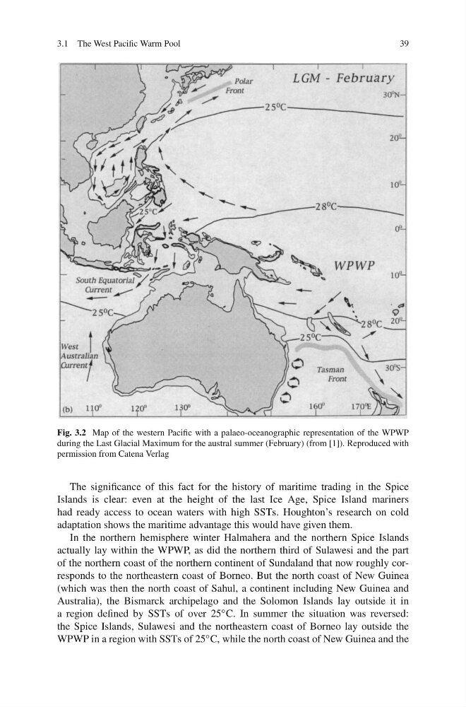
Fig. 3.2 Map of the western Pacific with a palaeo-oceanographic representation of the WPWP
during the Last Glacial Maximum for the austral summer (February) (from [1]). Reproduced with
permission from Catena Verlag
The significance of this fact for the history of maritime trading in the Spice
Islands is clear: even at the height of the last Ice Age, Spice Island mariners
had ready access to ocean waters with high SSTs. Houghton’s research on cold
adaptation shows the maritime advantage this would have given them.
In the northern hemisphere winter Halmahera and the northern Spice Islands
actually lay within the WPWP, as did the northern third of Sulawesi and the part
of the northern coast of the northern continent of Sundaland that now roughly corresponds to the northeastern coast of Borneo. But the north coast of New Guinea
(which was then the north coast of Sahul, a continent including New Guinea and
Australia), the Bismarck archipelago and the Solomon Islands lay outside it in
a region defined by SSTs of over 25 ◦ C. In summer the situation was reversed:
the Spice Islands, Sulawesi and the northeastern coast of Borneo lay outside the
WPWP in a region with SSTs of 25 ◦ C, while the north coast of New Guinea and the
39
Fig. 3.2 Map of the western Pacific with a palaeo-oceanographic representation of the WPWP
during the Last Glacial Maximum for the austral summer (February) (from [1]). Reproduced with
permission from Catena Verlag
The significance of this fact for the history of maritime trading in the Spice
Islands is clear: even at the height of the last Ice Age, Spice Island mariners
had ready access to ocean waters with high SSTs. Houghton’s research on cold
adaptation shows the maritime advantage this would have given them.
In the northern hemisphere winter Halmahera and the northern Spice Islands
actually lay within the WPWP, as did the northern third of Sulawesi and the part
of the northern coast of the northern continent of Sundaland that now roughly corresponds to the northeastern coast of Borneo. But the north coast of New Guinea
(which was then the north coast of Sahul, a continent including New Guinea and
Australia), the Bismarck archipelago and the Solomon Islands lay outside it in
a region defined by SSTs of over 25 ◦ C. In summer the situation was reversed:
the Spice Islands, Sulawesi and the northeastern coast of Borneo lay outside the
WPWP in a region with SSTs of 25 ◦ C, while the north coast of New Guinea and the