

Ridge axis and plane define the position of the spreading center.
Neovolcanic zone lies on the ridge axis where melt is
delivered to the surface and lavas erupt.
Hydrothermal circulation is a process where seawater
is circulated and heated in the crust.
Hydrothermal vent field (also known as black smokers)
is the site on the seafloor where mineral-laden hot water
exits the seafloor.
Axial melt lens (AML) is a thin body of magma seismically imaged beneath oceanic spreading centers.
Magma chamber is a domain beneath ridge crests
between melt lens and Moho comprised mixtures of melt
and crystals.
Layer 2A is the seismically defined top layer of oceanic
basaltic crust made of lava flows.
Layer 2B is the seismically defined layer between layer
2A and layer 3, the gabbroic layer, consisting of a diabase
dike sequence.
Lid comprises the basaltic layers 2A and 2B above the
axial melt lens.
Layer 3 is the seismically defined layer comprised of
gabbro unit between the lid and upper mantle.
Moho is the seismically defined boundary between the
crust and mantle.
Lithosphere is the upper layer of the earth comprised of
the uppermost mantle and crust that moves as a rigid layer
over the asthenosphere.
Asthenosphere is the deformable part of the earth mantle over which the lithosphere may move independently.
Seismic reflection is a geophysical technique to image
to sharp physical boundary in the crust.
Seismic refraction (also referred as tomography) is a
geophysical technique to image large-scale velocity structure of the earth.
Introduction
Plate tectonic theory defines the movement of the upper
part of the earth’s surface where plates (lithosphere) move
over the asthenosphere. Different plates interact with one
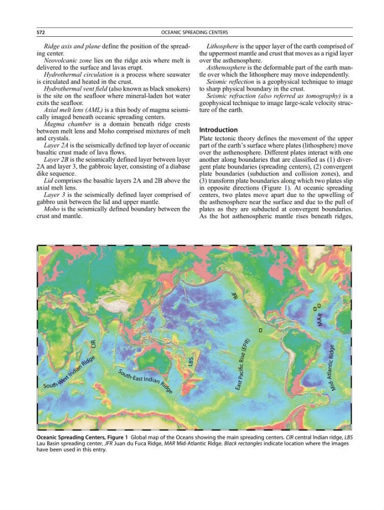
another along boundaries that are classified as (1) divergent plate boundaries (spreading centers), (2) convergent
plate boundaries (subduction and collision zones), and
(3) transform plate boundaries along which two plates slip
in opposite directions (Figure 1). At oceanic spreading
centers, two plates move apart due to the upwelling of
the asthenosphere near the surface and due to the pull of
plates as they are subducted at convergent boundaries.
As the hot asthenospheric mantle rises beneath ridges,
Oceanic Spreading Centers, Figure 1 Global map of the Oceans showing the main spreading centers. CIR central Indian ridge, LBS
Lau Basin spreading center, JFR Juan du Fuca Ridge, MAR Mid-Atlantic Ridge. Black rectangles indicate location where the images
have been used in this entry.
572
OCEANIC SPREADING CENTERS