

18°N
66°W
6 4 °W
6 2 °W
6 0 °W
5 8 °W
16°N
14°N
Grenada backarc
basin
Lesser Antilles
volcanic arc
Barbados
accretionary
prism
Tobago forearc
basin
200 km
Shallow depth
Legend
Earthquake Depth
Earthquake Magnitude
Topo / Bathy
Intermediate depth
4 - 5
8000
7000
6000
5000
4000
3000
2000
1000
−1000
−2000
−3000
−4000
−5000
−6000
−7000
−8000
−9000
−10000
−11000
0
5 - 6
6 - 7
7 - 8
Active Volcanoes
Major World Faults
and CBTH 2014
basement faults
Plate Boundaries
(from Bird 2002)
12°N
10°N
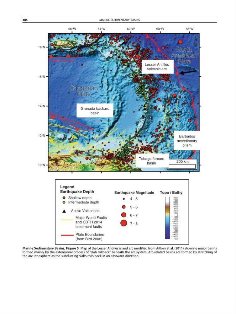
Marine Sedimentary Basins, Figure 5 Map of the Lesser Antilles island arc modified from Aitken et al. (2011) showing major basins
formed mainly by the extensional process of “slab rollback” beneath the arc system. Arc-related basins are formed by stretching of
the arc lithosphere as the subducting slabs rolls back in an eastward direction.
486
MARINE SEDIMENTARY BASINS