

60°E
a
b
75°N
70°N
65°N
60°N
55°N
Cross section (Fig 5B)
West Siberian Basin
Siberian Platform
Paleozoic Basement
SG 6
T
X
T
X’
?
m
9000
8000
7000
6000
5000
4000
3000
2000
1000
−1000
−2000
−3000
−4000
−5000
−6000
0
Legend
Topo / Bathy
Country Boundaries
Triassic Rifts
Sediment Thickmess (from Laske and Masters. 1997)
500 km
65°E
7 0 °E
7 5 °E
8 0 °E
8 5 °E
9 0 °E
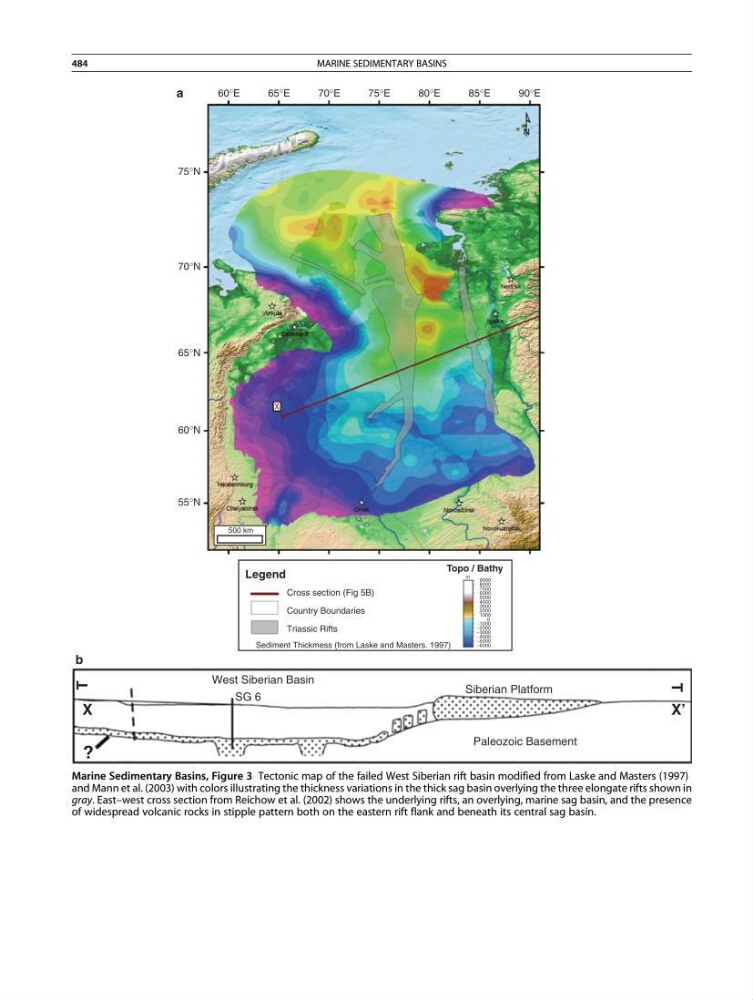
Marine Sedimentary Basins, Figure 3 Tectonic map of the failed West Siberian rift basin modified from Laske and Masters (1997)
and Mann et al. (2003) with colors illustrating the thickness variations in the thick sag basin overlying the three elongate rifts shown in
gray. East–west cross section from Reichow et al. (2002) shows the underlying rifts, an overlying, marine sag basin, and the presence
of widespread volcanic rocks in stipple pattern both on the eastern rift flank and beneath its central sag basin.
484
MARINE SEDIMENTARY BASINS