

20°E
2 mm/yr
800 km
GPS Vectors
8000
−8000
−9000
−10000
−11000
7000
−7000
6000
−6000
5000
−5000
4000
−4000
3000
−3000
2000
−2000
1000
−1000
0
Legend
Topo / Bathy
Volcanoes
Northern MER
Central MER
Major World Faults
Active
Potentially active
Solfatara stage
Plate Boundaries
(from Bird 2002)
Country Boundaries
Cross Sections (Fig 4B)
NW
Guraghe
border fault
Syn-rift volcanics
Boseti
magmatic
segment
Arboye
border fault
Pre-rift volcanics
(Eocene-Oligocene)
Syn-rift volcanics
(Miocene-Pliocene)
Syn-rift volcanics
(Pliocene-Pleistocene)
SE
WFB
Asela
border fault Mt Chilalo
E
W
4
2
0
0
km
−2
−4
4
2
0
km
−2
−4
0
50
100
150 km
50
100
150 km
15°N
10°N
5°N
0°″
5°″S
10°S
15°S
20°S
25°E
3 0 °E
3 5 °E
4 0 °E
4 5 °E
5 0 °E
5 5 °E
A’
B’
A
a
b
B
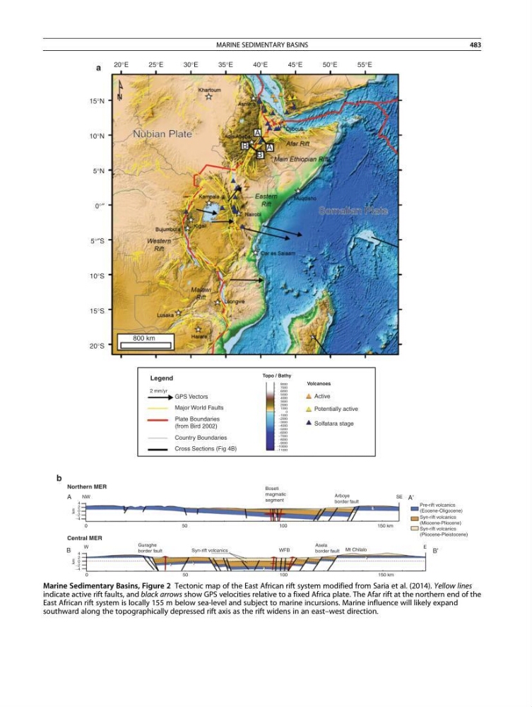
Marine Sedimentary Basins, Figure 2 Tectonic map of the East African rift system modified from Saria et al. (2014). Yellow lines
indicate active rift faults, and black arrows show GPS velocities relative to a fixed Africa plate. The Afar rift at the northern end of the
East African rift system is locally 155 m below sea-level and subject to marine incursions. Marine influence will likely expand
southward along the topographically depressed rift axis as the rift widens in an east–west direction.
MARINE SEDIMENTARY BASINS
483