

Lake Geneva and Lake Constance (Switzerland) (Müller,
1966; Reineck and Singh, 1973) and Lake Ayakum Delta,
Tibet (Figure 2).
Bayhead/lagoonal deltas
Bayhead/lagoonal deltas are located in the upper reaches
of the coastal zone. In many cases they represent an evolutionary step from a lacustrine delta during a sea-level
stillstand or withdrawal, which allows the delta to build
into coastal environments. Bayhead-delta settings are typically protected by barrier-island systems or remnants of
preexisting antecedent topography, resulting in a
low-energy environment. Examples of bayhead deltas
are found within the northern part of Mobile Bay (USA,
Alabama; Kindinger et al., 1994), Trinity Bay and San
Antonio Bay (USA, Texas; McEwen, 1969; Donaldson
et al., 1970; van Heerden and Roberts, 1988), and
Merrymeeting Bay, Maine (Fenster et al., 2005). One of
the largest bayhead deltas in the world exists in the Rio
de la Plata at the border between northern Argentina and
Uruguay where the Parana and Uruguay Rivers have combined to build a bayhead delta 280 km long and
40 km wide.
Continental shelf deltas
Continental shelf deltas develop during prolonged
sea-level stillstands and a moderate sea-level fall.
Trailing-edge or marginal-sea continental shelf deltas typically are characterized by an abundant sediment supply,
and their geomorphology reflects the wave and tidal conditions in which they develop. Examples of continental
shelf deltas include those associated with rivers of the
Lena along the Russian Siberian coast (Figure 3), the Mississippi in Louisiana (USA) (Figure 4), the Ebro in Spain,
the Colville in Alaska (USA) (Frazier, 1967; Maldonado,
1975; Naidu and Mowatt, 1975; Alonso et al., 1990), the
Ganges-Brahmaputra (Goodbred and Kuehl, 2000), and
those along the East China Sea (Zhou et al., 2014).
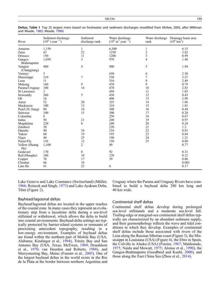
Deltas, Table 1 Top 25 largest rivers based on freshwater and sediment discharges (modified from McKee, 2005, after Milliman
and Meade, 1983; Meade, 1996)
River
Sediment discharge
(10
6 t year
À1
)
Sediment
discharge rank
Water discharge
(10
9 m
3 year
À1 )
Water discharge
rank
Drainage basin area
(10
6 km
2 )
Amazon
1,150
1
6,300
1
6.15
Zaire
43
22
1250
2
3.82
Orinoco
150
11
1200
3
0.99
GangesBrahmaputra
1,050
3
970
4
1.48
Yangtze
(Changjiang)
480
4
900
5
1.94
Yenisey
5
630
6
2.58
Mississippi
210
7
530
7
3.27
Lena
11
510
8
2.49
Mekong
160
9
470
9
0.79
Parana/Uruguay 100
14
470
10
2.83
St Lawrence
3
450
11
1.03
Irrawaddy
260
5
430
12
0.43
Ob
16
400
13
2.99
Amur
52
20
325
14
1.86
Mackenzie
100
13
310
15
1.81
Pearl (Xi Jiang) 80
16
300
16
0.44
Salween
100
15
300
17
0.28
Columbia
8
250
18
0.67
Indus
50
21
240
19
0.97
Magdalena
220
6
240
20
0.24
Zambezi
20
220
21
1.2
Danube
40
24
210
22
0.81
Yukon
60
19
195
23
0.84
Niger
40
25
190
24
1.21
Purari/Fly
110
12
150
25
0.09
Yellow (Huang
He)
1,100
2
49
0.77
Godavari
170
8
92
0.31
Red (Hunghe)
160
10
120
0.12
Copper
70
17
39
0.06
Choshui
66
18
0.003
Liao He
41
23
6
0.17
DELTAS
173
1966; Reineck and Singh, 1973) and Lake Ayakum Delta,
Tibet (Figure 2).
Bayhead/lagoonal deltas
Bayhead/lagoonal deltas are located in the upper reaches
of the coastal zone. In many cases they represent an evolutionary step from a lacustrine delta during a sea-level
stillstand or withdrawal, which allows the delta to build
into coastal environments. Bayhead-delta settings are typically protected by barrier-island systems or remnants of
preexisting antecedent topography, resulting in a
low-energy environment. Examples of bayhead deltas
are found within the northern part of Mobile Bay (USA,
Alabama; Kindinger et al., 1994), Trinity Bay and San
Antonio Bay (USA, Texas; McEwen, 1969; Donaldson
et al., 1970; van Heerden and Roberts, 1988), and
Merrymeeting Bay, Maine (Fenster et al., 2005). One of
the largest bayhead deltas in the world exists in the Rio
de la Plata at the border between northern Argentina and
Uruguay where the Parana and Uruguay Rivers have combined to build a bayhead delta 280 km long and
40 km wide.
Continental shelf deltas
Continental shelf deltas develop during prolonged
sea-level stillstands and a moderate sea-level fall.
Trailing-edge or marginal-sea continental shelf deltas typically are characterized by an abundant sediment supply,
and their geomorphology reflects the wave and tidal conditions in which they develop. Examples of continental
shelf deltas include those associated with rivers of the
Lena along the Russian Siberian coast (Figure 3), the Mississippi in Louisiana (USA) (Figure 4), the Ebro in Spain,
the Colville in Alaska (USA) (Frazier, 1967; Maldonado,
1975; Naidu and Mowatt, 1975; Alonso et al., 1990), the
Ganges-Brahmaputra (Goodbred and Kuehl, 2000), and
those along the East China Sea (Zhou et al., 2014).
Deltas, Table 1 Top 25 largest rivers based on freshwater and sediment discharges (modified from McKee, 2005, after Milliman
and Meade, 1983; Meade, 1996)
River
Sediment discharge
(10
6 t year
À1
)
Sediment
discharge rank
Water discharge
(10
9 m
3 year
À1 )
Water discharge
rank
Drainage basin area
(10
6 km
2 )
Amazon
1,150
1
6,300
1
6.15
Zaire
43
22
1250
2
3.82
Orinoco
150
11
1200
3
0.99
GangesBrahmaputra
1,050
3
970
4
1.48
Yangtze
(Changjiang)
480
4
900
5
1.94
Yenisey
5
630
6
2.58
Mississippi
210
7
530
7
3.27
Lena
11
510
8
2.49
Mekong
160
9
470
9
0.79
Parana/Uruguay 100
14
470
10
2.83
St Lawrence
3
450
11
1.03
Irrawaddy
260
5
430
12
0.43
Ob
16
400
13
2.99
Amur
52
20
325
14
1.86
Mackenzie
100
13
310
15
1.81
Pearl (Xi Jiang) 80
16
300
16
0.44
Salween
100
15
300
17
0.28
Columbia
8
250
18
0.67
Indus
50
21
240
19
0.97
Magdalena
220
6
240
20
0.24
Zambezi
20
220
21
1.2
Danube
40
24
210
22
0.81
Yukon
60
19
195
23
0.84
Niger
40
25
190
24
1.21
Purari/Fly
110
12
150
25
0.09
Yellow (Huang
He)
1,100
2
49
0.77
Godavari
170
8
92
0.31
Red (Hunghe)
160
10
120
0.12
Copper
70
17
39
0.06
Choshui
66
18
0.003
Liao He
41
23
6
0.17
DELTAS
173