

national jurisdiction (USA); (2) physical landmarks such
as shoreline, continental shelf, tidal marks (Costa Rica
and India), and depth or isobaths (e.g., China and Indonesia); and (3) a combination of arbitrary distances and physical marks such as an arbitrary oceanward distance in
kilometers from a tidal mark (e.g., Brazil, Israel, Sri
Lanka).
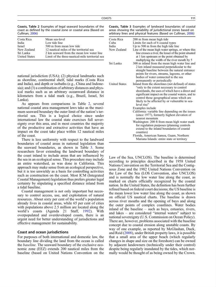
As appears from comparisons in Table 2, several
national coastal area management laws take as the maximum seaward boundary the outer limit of the nation’s territorial sea. This is a logical choice since under
international law the coastal state exercises full sovereignty over this area, and in most countries the majority
of the productive and extractive activities that have an
impact on the coast take place within 12 nautical miles
of the coast.
There is less uniformity with respect to the landward
boundaries of coastal areas in national legislation than
the seaward boundaries, as shown in Table 3. Some
researchers favor extending the landward boundary of
the coast inland to include areas that are influenced by
the sea in an ecological sense. This procedure may include
an entire watershed, as was done in California. This
approach may make sense from an ecological perspective,
but it is too unwieldy as a basis for controlling activities
such as construction on the coast. Most ICM (Integrated
Coastal Management) legislation thus prefers greater legal
certainty by stipulating a specified distance inland from
a tidal baseline.
Coastal management is not only important but necessary to control access, use, and exploitation of natural
resources. About sixty per cent of the world’s population
already lives in coastal areas, while 65 per cent of cities
with populations above 2.5 million are located along the
world’s coasts (Agenda 21 Staff, 1992). With
overpopulated and overdeveloped coasts, there is an
urgent need for better understanding of jurisdictions and
effective management for sustainability.
Coast and ocean jurisdictions
For purposes of both international and domestic law, the
boundary line dividing the land from the ocean is called
the baseline. The seaward boundary of the exclusive economic zone (EEZ) extends 200 nautical miles from the
baseline (based on United Nations Convention on the
Law of the Sea, UNCLOS). The baseline is determined
according to principles described in the 1958 United
Nations Convention on the Territorial Sea and the Contiguous Zone and the 1982 United Nations Convention on
the Law of the Sea (LOS Convention, also UNCLOS)
and is normally the low water line along the coast, as
marked on charts officially recognized by the coastal
nation. In the United States, the definition has been further
refined based on federal court decisions; the US baseline is
the mean lower low water line along the coast, as shown
on official US nautical charts. The baseline is drawn
across river mouths and the opening of bays and along
the outer points of complex coastlines. Water bodies
inland of the baseline – such as bays, estuaries, rivers,
and lakes – are considered “internal waters” subject to
national sovereignty (U.S. Commission on Ocean Policy).
There are, however, problems associated with the baseline
concept due to coastal erosion along unstable coasts. By
way of one example, as reported by McGlashan, Duck,
and Reid (2008), under British property laws, it is possible
that a small area of the upper beach (which regularly
changes in shape and size on the foreshore) can be owned
by adjacent landowners (technically under their control)
despite being regularly inundated by the tides, which normally would be thought of as being owned by the Crown.
Coasts, Table 2 Examples of legal seaward boundaries of the
coast as defined by the coastal zone or coastal area (Based on
Cullinan, 2006)
Costa Rica
Mean sea-level
India
Low tide line
Israel
500 m from mean low tide
New Zealand
12 nautical miles of the territorial sea
Sri Lanka
2 km seaward from the mean low water line
United States
Limit of the three-nautical-mile territorial sea
Coasts, Table 3 Examples of landward boundaries of coastal
areas showing the variability of jurisdictional zones based on
arbitrary lines and physical features (Based on Cullinan, 2006)
Costa Rica
200 m from mean high tide
Cuba
Limits for each of 6 coastal types
India
Up to 500 m from the high tide line
New Zealand
Line of the mean high water springs, or where this
line crosses a river, the lesser of the point situated
at 1 km upstream or the point obtained by
multiplying the width of the river mouth by 5
Sri Lanka
300 m inland from the mean high water line and
2 km inland measured perpendicular to the
straight baseline between the natural entrance
points for rivers, streams, lagoons, or other
bodies of water connected to the sea
permanently or periodically
United States
Inland from the shorelines (not defined) of states
“only to the extent necessary to control
shorelands, the uses of which have a direct and
significant impact on the coastal waters, and to
control those geographical areas which are
likely to be affected by or vulnerable to sealevel rise”
Examples include
California: variable line depending on the issues
(since 1977), formerly highest elevation of
nearest mountain
Washington: 200 ft from mean high water mark
for regulation purposes (planning controls
extend to the inland boundaries of coastal
counties)
Florida, American Samoa, Guam, Northern
Mariana Islands: entire state or territory
COASTS
111
as shoreline, continental shelf, tidal marks (Costa Rica
and India), and depth or isobaths (e.g., China and Indonesia); and (3) a combination of arbitrary distances and physical marks such as an arbitrary oceanward distance in
kilometers from a tidal mark (e.g., Brazil, Israel, Sri
Lanka).
As appears from comparisons in Table 2, several
national coastal area management laws take as the maximum seaward boundary the outer limit of the nation’s territorial sea. This is a logical choice since under
international law the coastal state exercises full sovereignty over this area, and in most countries the majority
of the productive and extractive activities that have an
impact on the coast take place within 12 nautical miles
of the coast.
There is less uniformity with respect to the landward
boundaries of coastal areas in national legislation than
the seaward boundaries, as shown in Table 3. Some
researchers favor extending the landward boundary of
the coast inland to include areas that are influenced by
the sea in an ecological sense. This procedure may include
an entire watershed, as was done in California. This
approach may make sense from an ecological perspective,
but it is too unwieldy as a basis for controlling activities
such as construction on the coast. Most ICM (Integrated
Coastal Management) legislation thus prefers greater legal
certainty by stipulating a specified distance inland from
a tidal baseline.
Coastal management is not only important but necessary to control access, use, and exploitation of natural
resources. About sixty per cent of the world’s population
already lives in coastal areas, while 65 per cent of cities
with populations above 2.5 million are located along the
world’s coasts (Agenda 21 Staff, 1992). With
overpopulated and overdeveloped coasts, there is an
urgent need for better understanding of jurisdictions and
effective management for sustainability.
Coast and ocean jurisdictions
For purposes of both international and domestic law, the
boundary line dividing the land from the ocean is called
the baseline. The seaward boundary of the exclusive economic zone (EEZ) extends 200 nautical miles from the
baseline (based on United Nations Convention on the
Law of the Sea, UNCLOS). The baseline is determined
according to principles described in the 1958 United
Nations Convention on the Territorial Sea and the Contiguous Zone and the 1982 United Nations Convention on
the Law of the Sea (LOS Convention, also UNCLOS)
and is normally the low water line along the coast, as
marked on charts officially recognized by the coastal
nation. In the United States, the definition has been further
refined based on federal court decisions; the US baseline is
the mean lower low water line along the coast, as shown
on official US nautical charts. The baseline is drawn
across river mouths and the opening of bays and along
the outer points of complex coastlines. Water bodies
inland of the baseline – such as bays, estuaries, rivers,
and lakes – are considered “internal waters” subject to
national sovereignty (U.S. Commission on Ocean Policy).
There are, however, problems associated with the baseline
concept due to coastal erosion along unstable coasts. By
way of one example, as reported by McGlashan, Duck,
and Reid (2008), under British property laws, it is possible
that a small area of the upper beach (which regularly
changes in shape and size on the foreshore) can be owned
by adjacent landowners (technically under their control)
despite being regularly inundated by the tides, which normally would be thought of as being owned by the Crown.
Coasts, Table 2 Examples of legal seaward boundaries of the
coast as defined by the coastal zone or coastal area (Based on
Cullinan, 2006)
Costa Rica
Mean sea-level
India
Low tide line
Israel
500 m from mean low tide
New Zealand
12 nautical miles of the territorial sea
Sri Lanka
2 km seaward from the mean low water line
United States
Limit of the three-nautical-mile territorial sea
Coasts, Table 3 Examples of landward boundaries of coastal
areas showing the variability of jurisdictional zones based on
arbitrary lines and physical features (Based on Cullinan, 2006)
Costa Rica
200 m from mean high tide
Cuba
Limits for each of 6 coastal types
India
Up to 500 m from the high tide line
New Zealand
Line of the mean high water springs, or where this
line crosses a river, the lesser of the point situated
at 1 km upstream or the point obtained by
multiplying the width of the river mouth by 5
Sri Lanka
300 m inland from the mean high water line and
2 km inland measured perpendicular to the
straight baseline between the natural entrance
points for rivers, streams, lagoons, or other
bodies of water connected to the sea
permanently or periodically
United States
Inland from the shorelines (not defined) of states
“only to the extent necessary to control
shorelands, the uses of which have a direct and
significant impact on the coastal waters, and to
control those geographical areas which are
likely to be affected by or vulnerable to sealevel rise”
Examples include
California: variable line depending on the issues
(since 1977), formerly highest elevation of
nearest mountain
Washington: 200 ft from mean high water mark
for regulation purposes (planning controls
extend to the inland boundaries of coastal
counties)
Florida, American Samoa, Guam, Northern
Mariana Islands: entire state or territory
COASTS
111