

relative elevation above or below the terrain. The simplest way to do so is to
generalize DEM by low pass filter and subtract it from original DEM (Davis 2012).
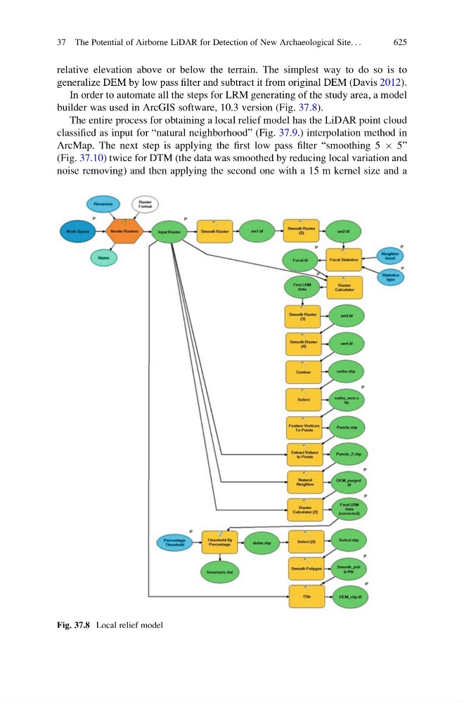
In order to automate all the steps for LRM generating of the study area, a model
builder was used in ArcGIS software, 10.3 version (Fig. 37.8).
The entire process for obtaining a local relief model has the LiDAR point cloud
classified as input for “natural neighborhood” (Fig. 37.9.) interpolation method in
ArcMap. The next step is applying the first low pass filter “smoothing 5 Â 5”
(Fig. 37.10) twice for DTM (the data was smoothed by reducing local variation and
noise removing) and then applying the second one with a 15 m kernel size and a
Fig. 37.8 Local relief model
37 The Potential of Airborne LiDAR for Detection of New Archaeological Site. . .
625