

5.4 Estuaries in the Southern North Sea Region
97
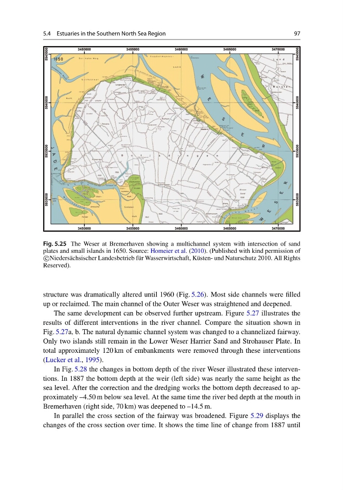
Fig. 5.25 The Weser at Bremerhaven showing a multichannel system with intersection of sand
plates and small islands in 1650. Source: Homeier et al. (2010). (Published with kind permission of
c
Niedersächsischer Landesbetrieb für Wasserwirtschaft, Küsten- und Naturschutz 2010. All Rights
Reserved).
structure was dramatically altered until 1960 (Fig. 5.26). Most side channels were filled
up or reclaimed. The main channel of the Outer Weser was straightened and deepened.
The same development can be observed further upstream. Figure 5.27 illustrates the
results of different interventions in the river channel. Compare the situation shown in
Fig. 5.27a, b. The natural dynamic channel system was changed to a channelized fairway.
Only two islands still remain in the Lower Weser Harrier Sand and Strohauser Plate. In
total approximately 120 km of embankments were removed through these interventions
(Lucker et al., 1995).
In Fig. 5.28 the changes in bottom depth of the river Weser illustrated these interventions. In 1887 the bottom depth at the weir (left side) was nearly the same height as the
sea level. After the correction and the dredging works the bottom depth decreased to approximately –4.50 m below sea level. At the same time the river bed depth at the mouth in
Bremerhaven (right side, 70 km) was deepened to –14.5 m.
In parallel the cross section of the fairway was broadened. Figure 5.29 displays the
changes of the cross section over time. It shows the time line of change from 1887 until
97
Fig. 5.25 The Weser at Bremerhaven showing a multichannel system with intersection of sand
plates and small islands in 1650. Source: Homeier et al. (2010). (Published with kind permission of
c
Niedersächsischer Landesbetrieb für Wasserwirtschaft, Küsten- und Naturschutz 2010. All Rights
Reserved).
structure was dramatically altered until 1960 (Fig. 5.26). Most side channels were filled
up or reclaimed. The main channel of the Outer Weser was straightened and deepened.
The same development can be observed further upstream. Figure 5.27 illustrates the
results of different interventions in the river channel. Compare the situation shown in
Fig. 5.27a, b. The natural dynamic channel system was changed to a channelized fairway.
Only two islands still remain in the Lower Weser Harrier Sand and Strohauser Plate. In
total approximately 120 km of embankments were removed through these interventions
(Lucker et al., 1995).
In Fig. 5.28 the changes in bottom depth of the river Weser illustrated these interventions. In 1887 the bottom depth at the weir (left side) was nearly the same height as the
sea level. After the correction and the dredging works the bottom depth decreased to approximately –4.50 m below sea level. At the same time the river bed depth at the mouth in
Bremerhaven (right side, 70 km) was deepened to –14.5 m.
In parallel the cross section of the fairway was broadened. Figure 5.29 displays the
changes of the cross section over time. It shows the time line of change from 1887 until