

58
Exercise 5
CHANNEL MORPHOLOGY
CURRENT
The basin or trough containing the stream water is the stream channel. At any moment
in time, the channel is characteristic of the stream. The channel may be described by
length, width, depth, cross-sectional area, slope, aspect, and so on. Length, width, slope,
and aspect may be determined from simple measurement or, except for width, from a
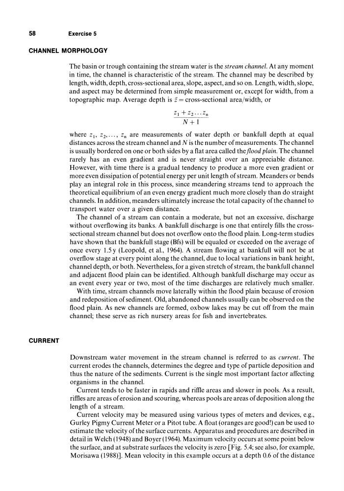
topographic map. Average depth is i = cross-sectional area/width, or
where Zl' Zz, ... , Zn are measurements of water depth or bankfull depth at equal
distances across the stream channel and N is the number of measurements. The channel
is usually bordered on one or both sides by a flat area called theflood plain. The channel
rarely has an even gradient and is never straight over an appreciable distance.
However, with time there is a gradual tendency to produce a more even gradient or
more even dissipation of potential energy per unit length of stream. Meanders or bends
play an integral role in this process, since meandering streams tend to approach the
theoretical equilibrium of an even energy gradient much more closely than do straight
channels. In addition, meanders ultimately increase the total capacity of the channel to
transport water over a given distance.
The channel of a stream can contain a moderate, but not an excessive, discharge
without overflowing its banks. A bankfull discharge is one that entirely fills the crosssectional stream channel but does not overflow onto the flood plain. Long-term studies
have shown that the bankfull stage (Bfs) will be equaled or exceeded on the average of
once every 1.5 y (Leopold, et aI., 1964). A stream flowing at bankfull will not be at
overflow stage at every point along the channel, due to local variations in bank height,
channel depth, or both. Nevertheless, for a given stretch of stream, the bankfull channel
and adjacent flood plain can be identified. Although bankfull discharge may occur as
an event every year or two, most of the time discharges are relatively much smaller.
With time, stream channels move laterally within the flood plain because of erosion
and redeposition of sediment. Old, abandoned channels usually can be observed on the
flood plain. As new channels are formed, oxbow lakes may be cut off from the main
channel; these serve as rich nursery areas for fish and invertebrates.
Downstream water movement in the stream channel is referred to as current. The
current erodes the channels, determines the degree and type of particle deposition and
thus the nature of the sediments. Current is the single most important factor affecting
organisms in the channel.
Current tends to be faster in rapids and rime areas and slower in pools. As a result,
rimes are areas of erosion and scouring, whereas pools are areas of deposition along the
length of a stream.
Current velocity may be measured using various types of meters and devices, e.g.,
Gurley Pigmy Current Meter or a Pitot tube. A float (oranges are good!) can be used to
estimate the velocity of the surface currents. Apparatus and procedures are described in
detail in Welch (1948) and Boyer (1964). Maximum velocity occurs at some point below
the surface, and at substrate surfaces the velocity is zero [Fig. 5.4; see also, for example,
Morisawa (1988)]. Mean velocity in this example occurs at a depth 0.6 of the distance
Exercise 5
CHANNEL MORPHOLOGY
CURRENT
The basin or trough containing the stream water is the stream channel. At any moment
in time, the channel is characteristic of the stream. The channel may be described by
length, width, depth, cross-sectional area, slope, aspect, and so on. Length, width, slope,
and aspect may be determined from simple measurement or, except for width, from a
topographic map. Average depth is i = cross-sectional area/width, or
where Zl' Zz, ... , Zn are measurements of water depth or bankfull depth at equal
distances across the stream channel and N is the number of measurements. The channel
is usually bordered on one or both sides by a flat area called theflood plain. The channel
rarely has an even gradient and is never straight over an appreciable distance.
However, with time there is a gradual tendency to produce a more even gradient or
more even dissipation of potential energy per unit length of stream. Meanders or bends
play an integral role in this process, since meandering streams tend to approach the
theoretical equilibrium of an even energy gradient much more closely than do straight
channels. In addition, meanders ultimately increase the total capacity of the channel to
transport water over a given distance.
The channel of a stream can contain a moderate, but not an excessive, discharge
without overflowing its banks. A bankfull discharge is one that entirely fills the crosssectional stream channel but does not overflow onto the flood plain. Long-term studies
have shown that the bankfull stage (Bfs) will be equaled or exceeded on the average of
once every 1.5 y (Leopold, et aI., 1964). A stream flowing at bankfull will not be at
overflow stage at every point along the channel, due to local variations in bank height,
channel depth, or both. Nevertheless, for a given stretch of stream, the bankfull channel
and adjacent flood plain can be identified. Although bankfull discharge may occur as
an event every year or two, most of the time discharges are relatively much smaller.
With time, stream channels move laterally within the flood plain because of erosion
and redeposition of sediment. Old, abandoned channels usually can be observed on the
flood plain. As new channels are formed, oxbow lakes may be cut off from the main
channel; these serve as rich nursery areas for fish and invertebrates.
Downstream water movement in the stream channel is referred to as current. The
current erodes the channels, determines the degree and type of particle deposition and
thus the nature of the sediments. Current is the single most important factor affecting
organisms in the channel.
Current tends to be faster in rapids and rime areas and slower in pools. As a result,
rimes are areas of erosion and scouring, whereas pools are areas of deposition along the
length of a stream.
Current velocity may be measured using various types of meters and devices, e.g.,
Gurley Pigmy Current Meter or a Pitot tube. A float (oranges are good!) can be used to
estimate the velocity of the surface currents. Apparatus and procedures are described in
detail in Welch (1948) and Boyer (1964). Maximum velocity occurs at some point below
the surface, and at substrate surfaces the velocity is zero [Fig. 5.4; see also, for example,
Morisawa (1988)]. Mean velocity in this example occurs at a depth 0.6 of the distance