

32
H. Rott
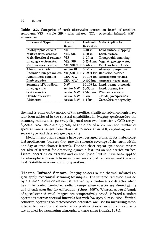
Table 2.2. Categories of earth observation sensors on board of satellites.
Acronyms: VIS - visible, SIR - solar infrared, TIR - terrestrial infrared, MW -
microwaves
Instrument Type
Spectral
Horizontal Main Application
Region
Resolution
Photographic camera
VIS
3-10 m
Land surface mapping
Multispectral scanner
VIS, SIR
6-80 m
Earth surface
Multidirectional scanner VIS
1-20 m
Topographic mapping
Imaging spectrometer
VIS, SIR
0.25-1 km Vegetat.,geology,water
Medium resol. scanner
VIS,SIR,TIR 0.5-5 km Earth surface, clouds
Atmospheric lidar
Active IR
0.1-1 km Atmosph. properties
Radiation budget radiom. VIS,SIR,TIR 20-200 km Radiation balance
Atmospheric sounder
TIR, MW
10-100 km Atmospheric profiles
Limb sounder
TIR, MW
>300 km Atmosph. trace gases
Scanning MW radiom.
MW
10-100 km Land, ocean, atmosph.
Imaging radar
Active MW 10-30 m
Land, oceans, ice
Scatterometer
Active MW 25-50 km Wind over oceans
Cloud/rain radar
Active MW 5 km
Clouds, precipitation
Altimeters
Active MW 1-5 km
Ocean&ice topography
the next is achieved by motion of the satellite. Significant advancements have
also been achieved in the spectral capabilities. In imaging spectrometers the
incoming radiation is spectrally dispersed onto two-dimensional CCD arrays.
Spectral resolutions are typically of the order of a few nm, the number of
spectral bands ranges from about 20 to more than 200, depending on the
sensor type and data storage capability.
Medium resolution scanners have been designed primarily for meteorological applications, because they provide synoptic coverage of the earth within
one day or even shorter intervals. Due the short repeat cycle these sensors
are also of interest for observing dynamic features on the earth's surface.
Lidars, operating on aircrafts and on the Space Shuttle, have been applied
for atmospheric research to measure aerosols, cloud properties, and the wind
field. Satellite missions are in preparation.
Thermal Infrared Sensors. Imaging sensors in the thermal infrared region apply mechanical scanning techniques. The infrared radiation emitted
by a surface resolution element is received by a photoelectric detector which
has to be cooled, controlled radiant temperature sources are viewed at the
end of each scan line for calibration (Schott, 1997). Whereas spectral bands
of spaceborne thermal imagers are comparatively broad, infrared sounders
operate in narrow spectral intervals but with low spatial resolution. Vertical
sounders, operating on meteorological satellites, are used for measuring atmospheric temperature and water vapor profiles. Special sounding instruments
are applied for monitoring atmospheric trace gases (Harris, 1994).
H. Rott
Table 2.2. Categories of earth observation sensors on board of satellites.
Acronyms: VIS - visible, SIR - solar infrared, TIR - terrestrial infrared, MW -
microwaves
Instrument Type
Spectral
Horizontal Main Application
Region
Resolution
Photographic camera
VIS
3-10 m
Land surface mapping
Multispectral scanner
VIS, SIR
6-80 m
Earth surface
Multidirectional scanner VIS
1-20 m
Topographic mapping
Imaging spectrometer
VIS, SIR
0.25-1 km Vegetat.,geology,water
Medium resol. scanner
VIS,SIR,TIR 0.5-5 km Earth surface, clouds
Atmospheric lidar
Active IR
0.1-1 km Atmosph. properties
Radiation budget radiom. VIS,SIR,TIR 20-200 km Radiation balance
Atmospheric sounder
TIR, MW
10-100 km Atmospheric profiles
Limb sounder
TIR, MW
>300 km Atmosph. trace gases
Scanning MW radiom.
MW
10-100 km Land, ocean, atmosph.
Imaging radar
Active MW 10-30 m
Land, oceans, ice
Scatterometer
Active MW 25-50 km Wind over oceans
Cloud/rain radar
Active MW 5 km
Clouds, precipitation
Altimeters
Active MW 1-5 km
Ocean&ice topography
the next is achieved by motion of the satellite. Significant advancements have
also been achieved in the spectral capabilities. In imaging spectrometers the
incoming radiation is spectrally dispersed onto two-dimensional CCD arrays.
Spectral resolutions are typically of the order of a few nm, the number of
spectral bands ranges from about 20 to more than 200, depending on the
sensor type and data storage capability.
Medium resolution scanners have been designed primarily for meteorological applications, because they provide synoptic coverage of the earth within
one day or even shorter intervals. Due the short repeat cycle these sensors
are also of interest for observing dynamic features on the earth's surface.
Lidars, operating on aircrafts and on the Space Shuttle, have been applied
for atmospheric research to measure aerosols, cloud properties, and the wind
field. Satellite missions are in preparation.
Thermal Infrared Sensors. Imaging sensors in the thermal infrared region apply mechanical scanning techniques. The infrared radiation emitted
by a surface resolution element is received by a photoelectric detector which
has to be cooled, controlled radiant temperature sources are viewed at the
end of each scan line for calibration (Schott, 1997). Whereas spectral bands
of spaceborne thermal imagers are comparatively broad, infrared sounders
operate in narrow spectral intervals but with low spatial resolution. Vertical
sounders, operating on meteorological satellites, are used for measuring atmospheric temperature and water vapor profiles. Special sounding instruments
are applied for monitoring atmospheric trace gases (Harris, 1994).