

Colour Plates of Chaps. 9-11
267
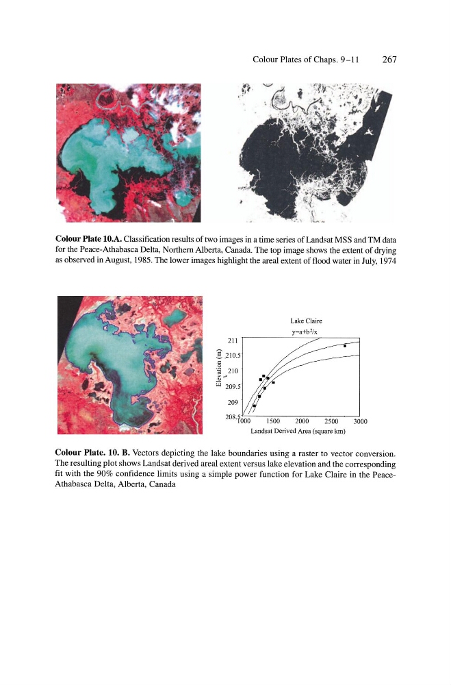
Colour Plate 10.A. Classification results of two images in a time series of Landsat MSS and TM data
for the Peace-Athabasca Delta, Northern Albe11a, Canada. The top image shows the extent of drying
as observed in August, 1985. The lower images highlight the areal extent of flood water in July, 1974
211
]:2105
g
'j;J 210
~#
iii
Lake Claire
y=a+b'/x
2000
2500
Landsat Derived Area (square Ian)
3000
Colour Plate. 10. B. Vectors depicting the lake boundaries using a raster to vector conversion.
The resulting plot shows Landsat derived areal extent versus lake elevation and the corresponding
fit with the 90% confidence limits using a simple power function for Lake Claire in the PeaceAthabasca Delta, Alberta, Canada
267
Colour Plate 10.A. Classification results of two images in a time series of Landsat MSS and TM data
for the Peace-Athabasca Delta, Northern Albe11a, Canada. The top image shows the extent of drying
as observed in August, 1985. The lower images highlight the areal extent of flood water in July, 1974
211
]:2105
g
'j;J 210
~#
iii
Lake Claire
y=a+b'/x
2000
2500
Landsat Derived Area (square Ian)
3000
Colour Plate. 10. B. Vectors depicting the lake boundaries using a raster to vector conversion.
The resulting plot shows Landsat derived areal extent versus lake elevation and the corresponding
fit with the 90% confidence limits using a simple power function for Lake Claire in the PeaceAthabasca Delta, Alberta, Canada