

268
Colour Plates of Chaps, 9-11
Town of Morris,
Manitoba, Canada
~~~~~~~!ir-protected by a ring
dike.
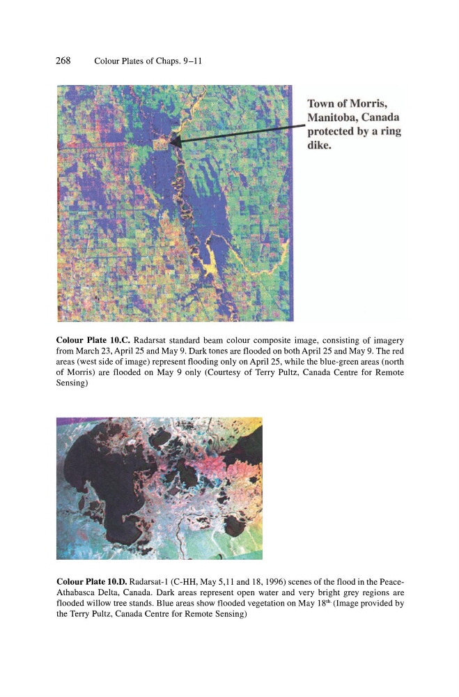
Colour Plate lO.C. Radarsat standard beam colour composite image, consisting of imagery
from March 23, April 25 and May 9, Dark tones are flooded on both April 25 and May 9, The red
areas (west side of image) represent flooding only on April 25, while the blue-green areas (north
of Morris) are flooded on May 9 only (Courtesy of Terry Pultz, Canada Centre for Remote
Sensing)
Colour Plate lO.D. Radarsat-l (C-HH, May 5,11 and 18, 1996) scenes of the flood in the PeaceAthabasca Delta, Canada, Dark areas represent open water and very bright grey regions are
flooded willow tree stands, Blue areas show flooded vegetation on May 18 th . (Image provided by
the Terry Pultz, Canada Centre for Remote Sensing)
Colour Plates of Chaps, 9-11
Town of Morris,
Manitoba, Canada
~~~~~~~!ir-protected by a ring
dike.
Colour Plate lO.C. Radarsat standard beam colour composite image, consisting of imagery
from March 23, April 25 and May 9, Dark tones are flooded on both April 25 and May 9, The red
areas (west side of image) represent flooding only on April 25, while the blue-green areas (north
of Morris) are flooded on May 9 only (Courtesy of Terry Pultz, Canada Centre for Remote
Sensing)
Colour Plate lO.D. Radarsat-l (C-HH, May 5,11 and 18, 1996) scenes of the flood in the PeaceAthabasca Delta, Canada, Dark areas represent open water and very bright grey regions are
flooded willow tree stands, Blue areas show flooded vegetation on May 18 th . (Image provided by
the Terry Pultz, Canada Centre for Remote Sensing)