

8 Evaporation
161
Air temperature (near surface) was derived from TIROS Operational Vertical
Sounder (TOVS) data (Susskind, 1993). Vapour pressure was also estimated with
the TOVS data, using the TOVS precipitable water to obtain vapour pressure with
a semi-empirical equation. The vapour pressure deficit was finally obtained calculating saturated vapour pressure from air temperature. The aerodynamic resistance
was estimated using wind speed fields produced with a Four Dimensional Data
Assimilation (4DDA) procedure (Schubert et aI., 1993). Finally the minimum rs
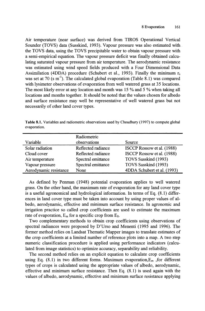
was set at 70 (s m'\ The calculated global evaporation (Table 8.1) was compared
with lysimeter observations of evaporation from well watered grass at 35 locations.
The most likely error at any location and month was 15 % and 5 % when taking all
locations and months together. It should be noted that the values chosen for albedo
and surface resistance may well be representative of well watered grass but not
necessarily of other land cover types.
Table 8.1. Variables and radiometric observations used by Choudhury (1997) to compute global
evaporation.
Variable
Solar radiation
Cloud cover
Air temperature
Vapour pressure
Aerodynamic resistance
Radiometric
observations
Reflected radiance
Reflected radiance
Spectral emittance
Spectral emittance
None
Source
ISCCP Rossow et aI. (1988)
ISCCP Rossow et aI. (1988)
TOVS Susskind (1993)
TOVS Susskind (1993)
4DDA Schubert et aI. (1993)
As defined by Penman (1948) potential evaporation applies to well watered
grass. On the other hand, the maximum rate of evaporation for any land cover type
is a useful agronomical and hydrological information. In terms of Eq. (8.1) differences in land cover type must be taken into account by using proper values of albedo, aerodynamic, effective and minimum surface resistance. In agronomic and
irrigation practice so called crop coefficients are used to estimate the maximum
rate of evaporation, Em for a specific crop from Eo.
Two complementary methods to obtain crop coefficients using observations of
spectral radiances were proposed by D'Urso and Menenti (1995 and 1996). The
former method relies on Landsat Thematic Mapper images to translate estimates of
the crop coefficients at a limited number of reference plots into a map. A two step
numeric classification procedure is applied using performance indicators (calculated from image statistics) to optimize accuracy, separability and reliability.
The second method relies on an explicit equation to calculate crop coefficients
using Eq. (8.1) in two different forms. Maximum evaporation, Em ,for different
types of crops is calculated using the appropriate values of albedo, aerodynamic,
effective and minimum surface resistance. Then Eq. (8.1) is used again with the
values of albedo, aerodynamic, effective and minimum surface resistance applying
161
Air temperature (near surface) was derived from TIROS Operational Vertical
Sounder (TOVS) data (Susskind, 1993). Vapour pressure was also estimated with
the TOVS data, using the TOVS precipitable water to obtain vapour pressure with
a semi-empirical equation. The vapour pressure deficit was finally obtained calculating saturated vapour pressure from air temperature. The aerodynamic resistance
was estimated using wind speed fields produced with a Four Dimensional Data
Assimilation (4DDA) procedure (Schubert et aI., 1993). Finally the minimum rs
was set at 70 (s m'\ The calculated global evaporation (Table 8.1) was compared
with lysimeter observations of evaporation from well watered grass at 35 locations.
The most likely error at any location and month was 15 % and 5 % when taking all
locations and months together. It should be noted that the values chosen for albedo
and surface resistance may well be representative of well watered grass but not
necessarily of other land cover types.
Table 8.1. Variables and radiometric observations used by Choudhury (1997) to compute global
evaporation.
Variable
Solar radiation
Cloud cover
Air temperature
Vapour pressure
Aerodynamic resistance
Radiometric
observations
Reflected radiance
Reflected radiance
Spectral emittance
Spectral emittance
None
Source
ISCCP Rossow et aI. (1988)
ISCCP Rossow et aI. (1988)
TOVS Susskind (1993)
TOVS Susskind (1993)
4DDA Schubert et aI. (1993)
As defined by Penman (1948) potential evaporation applies to well watered
grass. On the other hand, the maximum rate of evaporation for any land cover type
is a useful agronomical and hydrological information. In terms of Eq. (8.1) differences in land cover type must be taken into account by using proper values of albedo, aerodynamic, effective and minimum surface resistance. In agronomic and
irrigation practice so called crop coefficients are used to estimate the maximum
rate of evaporation, Em for a specific crop from Eo.
Two complementary methods to obtain crop coefficients using observations of
spectral radiances were proposed by D'Urso and Menenti (1995 and 1996). The
former method relies on Landsat Thematic Mapper images to translate estimates of
the crop coefficients at a limited number of reference plots into a map. A two step
numeric classification procedure is applied using performance indicators (calculated from image statistics) to optimize accuracy, separability and reliability.
The second method relies on an explicit equation to calculate crop coefficients
using Eq. (8.1) in two different forms. Maximum evaporation, Em ,for different
types of crops is calculated using the appropriate values of albedo, aerodynamic,
effective and minimum surface resistance. Then Eq. (8.1) is used again with the
values of albedo, aerodynamic, effective and minimum surface resistance applying