

45
Storm Impact on the Coastal Geomorphology and Current Field
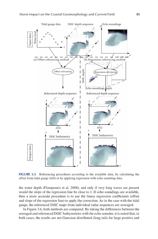
the water depth (Flampouris et al. 2008), and only if very long waves are present
would the slope of the regression line be close to 1. If echo soundings are available,
then a more accurate procedure is to use the linear regression coefficients (offset
and slope of the regression line) to apply the correction. As in the case with the tidal
gauge, the referenced DiSC maps from individual radar sequences are averaged.
In Figure 3.6, both methods are compared. By taking the differences between the
averaged and referenced DiSC bathymetries with the echo sounder, it is noted that, in
both cases, the results are not Gaussian distributed (long tails for large positive and
Tidal gauge data
Input data
DiSC depth
Echo soundings depth
Referenced depth sequence
DiSC bathymetry
DiSC bathymetry
Referenced depth sequence
Regression referencing
Offset referencing
DiSC depth sequence
Echo soundings
Output data
Water level
t
t
x
x
x
t
y
y
x
x
x
t
y
y
AVG
AVG
y
y
(a) Offset referencing method
(b) Regression referencing method
FIGURE 3.5 Referencing procedures according to the available data, by calculating the
offset from tidal gauge (left) or by applying regression with echo sounding data.
Storm Impact on the Coastal Geomorphology and Current Field
the water depth (Flampouris et al. 2008), and only if very long waves are present
would the slope of the regression line be close to 1. If echo soundings are available,
then a more accurate procedure is to use the linear regression coefficients (offset
and slope of the regression line) to apply the correction. As in the case with the tidal
gauge, the referenced DiSC maps from individual radar sequences are averaged.
In Figure 3.6, both methods are compared. By taking the differences between the
averaged and referenced DiSC bathymetries with the echo sounder, it is noted that, in
both cases, the results are not Gaussian distributed (long tails for large positive and
Tidal gauge data
Input data
DiSC depth
Echo soundings depth
Referenced depth sequence
DiSC bathymetry
DiSC bathymetry
Referenced depth sequence
Regression referencing
Offset referencing
DiSC depth sequence
Echo soundings
Output data
Water level
t
t
x
x
x
t
y
y
x
x
x
t
y
y
AVG
AVG
y
y
(a) Offset referencing method
(b) Regression referencing method
FIGURE 3.5 Referencing procedures according to the available data, by calculating the
offset from tidal gauge (left) or by applying regression with echo sounding data.