

530
Multiscale Hydrologic Remote Sensing: Perspectives and Applications
Test Case 1: Fire on August 23
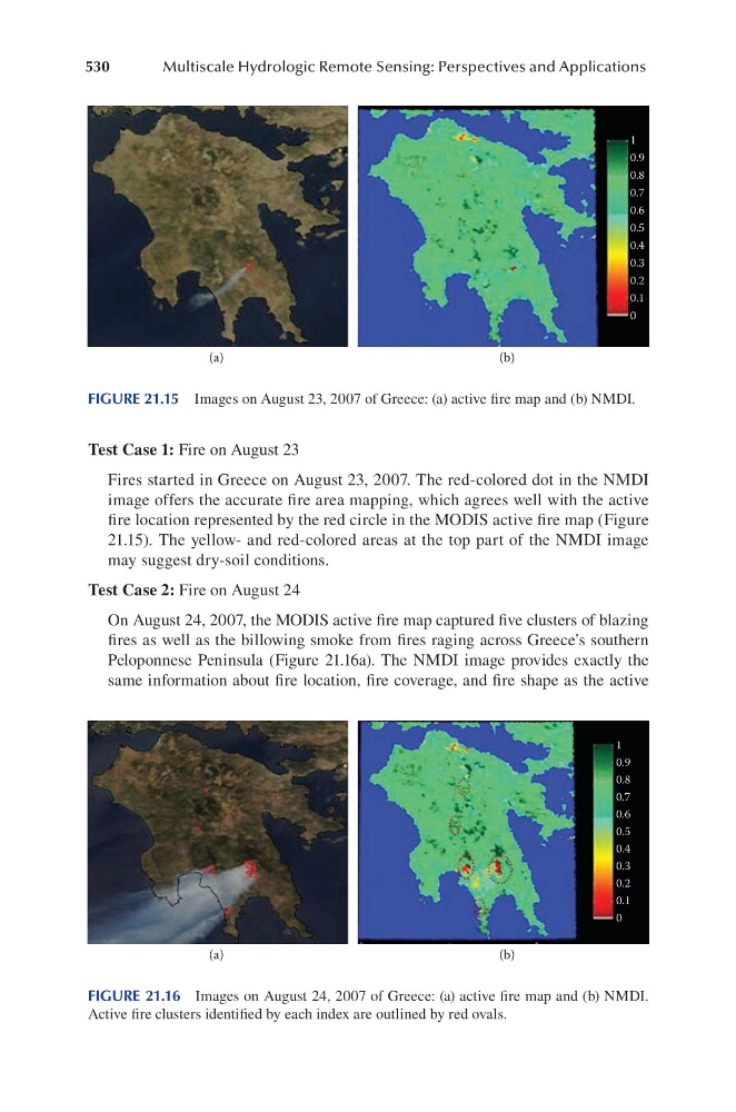
Fires started in Greece on August 23, 2007. The red-colored dot in the NMDI
image offers the accurate fire area mapping, which agrees well with the active
fire location represented by the red circle in the MODIS active fire map (Figure
21.15). The yellow- and red-colored areas at the top part of the NMDI image
may suggest dry-soil conditions.
Test Case 2: Fire on August 24
On August 24, 2007, the MODIS active fire map captured five clusters of blazing
fires as well as the billowing smoke from fires raging across Greece’s southern
Peloponnese Peninsula (Figure 21.16a). The NMDI image provides exactly the
same information about fire location, fire coverage, and fire shape as the active
1
0.9
0.8
0.7
0.6
0.5
0.4
0.3
0.2
0.1
0
(a)
(b)
FIGURE 21.15 Images on August 23, 2007 of Greece: (a) active fire map and (b) NMDI.
1
0.9
0.8
0.7
0.6
0.5
0.4
0.3
0.2
0.1
0
(a)
(b)
FIGURE 21.16 Images on August 24, 2007 of Greece: (a) active fire map and (b) NMDI.
Active fire clusters identified by each index are outlined by red ovals.