

531
Soil and Vegetation Moisture Changes for Forest Fire Events
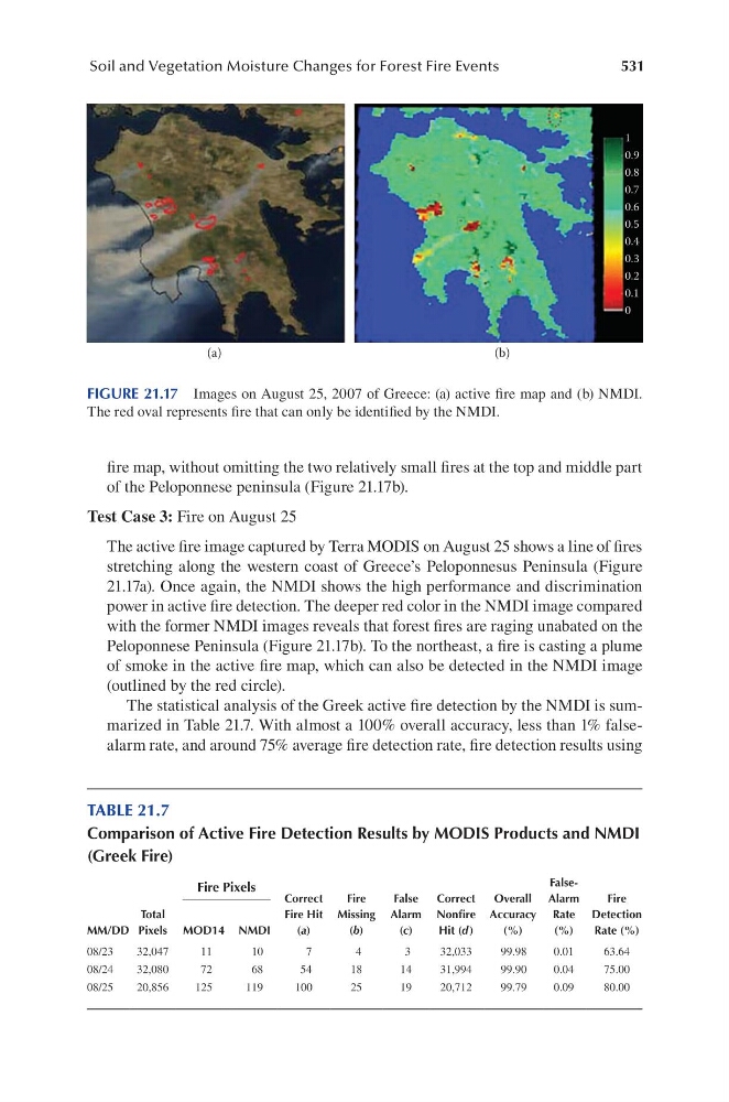
fire map, without omitting the two relatively small fires at the top and middle part
of the Peloponnese peninsula (Figure 21.17b).
Test Case 3: Fire on August 25
The active fire image captured by Terra MODIS on August 25 shows a line of fires
stretching along the western coast of Greece’s Peloponnesus Peninsula (Figure
21.17a). Once again, the NMDI shows the high performance and discrimination
power in active fire detection. The deeper red color in the NMDI image compared
with the former NMDI images reveals that forest fires are raging unabated on the
Peloponnese Peninsula (Figure 21.17b). To the northeast, a fire is casting a plume
of smoke in the active fire map, which can also be detected in the NMDI image
(outlined by the red circle).
The statistical analysis of the Greek active fire detection by the NMDI is summarized in Table 21.7. With almost a 100% overall accuracy, less than 1% falsealarm rate, and around 75% average fire detection rate, fire detection results using
1
0.9
0.8
0.7
0.6
0.5
0.4
0.3
0.2
0.1
0
(a)
(b)
FIGURE 21.17 Images on August 25, 2007 of Greece: (a) active fire map and (b) NMDI.
The red oval represents fire that can only be identified by the NMDI.
TABLE 21.7
Comparison of Active Fire Detection Results by MODIS Products and NMDI
(Greek Fire)
MM/DD
Total
Pixels
Fire Pixels
Correct
Fire Hit
(a)
Fire
Missing
(b)
False
Alarm
(c)
Correct
Nonfire
Hit (d )
Overall
Accuracy
(%)
FalseAlarm
Rate
(%)
Fire
Detection
Rate (%)
MOD14 NMDI
08/23
32,047
11
10
7
4
3
32,033
99.98
0.01
63.64
08/24
32,080
72
68
54
18
14
31,994
99.90
0.04
75.00
08/25
20,856
125
119
100
25
19
20,712
99.79
0.09
80.00