

256
Multiscale Hydrologic Remote Sensing: Perspectives and Applications
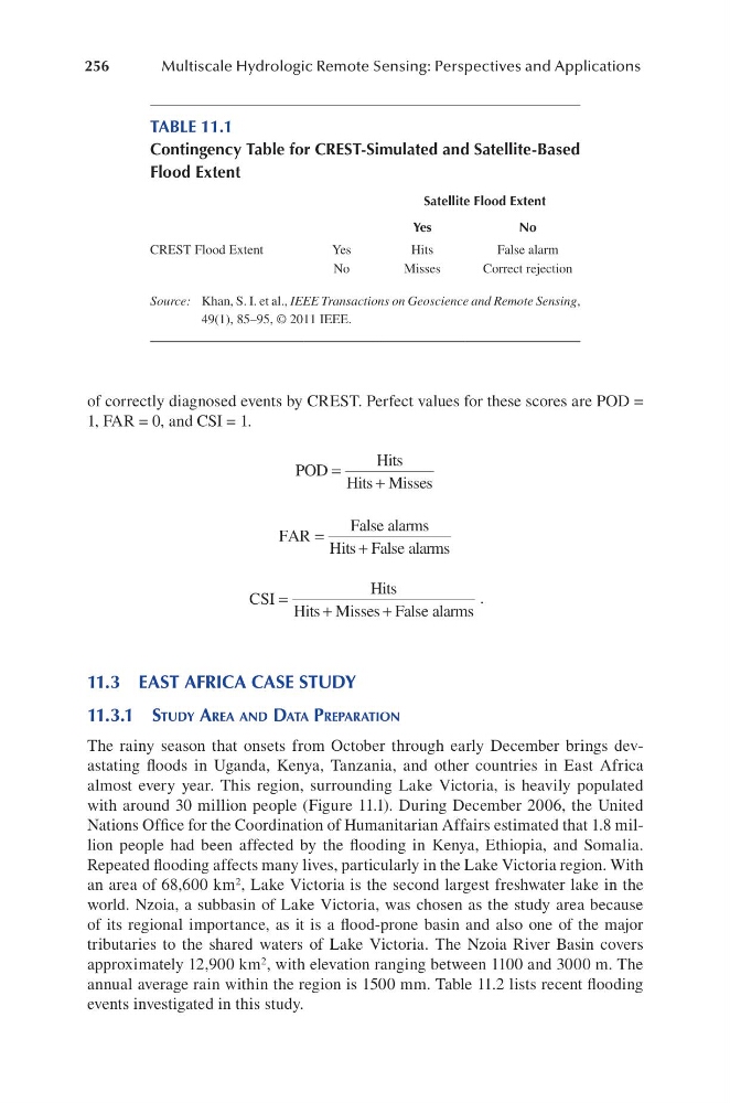
of correctly diagnosed events by CREST. Perfect values for these scores are POD =
1, FAR = 0, and CSI = 1.
POD
Hits
Hits Misses
=
+
FAR
False alarms
Hits False alarms
=
+
CSI
Hits
Hits Misses False alarms
=
+
+
.
11.3 EAST AFRICA CASE STUDY
11.3.1 Study aRea and data PRePaRation
The rainy season that onsets from October through early December brings devastating floods in Uganda, Kenya, Tanzania, and other countries in East Africa
almost every year. This region, surrounding Lake Victoria, is heavily populated
with around 30 million people (Figure 11.1). During December 2006, the United
Nations Office for the Coordination of Humanitarian Affairs estimated that 1.8 million people had been affected by the flooding in Kenya, Ethiopia, and Somalia.
Repeated flooding affects many lives, particularly in the Lake Victoria region. With
an area of 68,600 km 2 , Lake Victoria is the second largest freshwater lake in the
world. Nzoia, a subbasin of Lake Victoria, was chosen as the study area because
of its regional importance, as it is a flood-prone basin and also one of the major
tributaries to the shared waters of Lake Victoria. The Nzoia River Basin covers
approximately 12,900 km 2 , with elevation ranging between 1100 and 3000 m. The
annual average rain within the region is 1500 mm. Table 11.2 lists recent flooding
events investigated in this study.
TABLE 11.1
Contingency Table for CREST-Simulated and Satellite-Based
Flood Extent
Satellite Flood Extent
Yes
No
CREST Flood Extent
Yes
Hits
False alarm
No
Misses
Correct rejection
Source: Khan, S. I. et al., IEEE Transactions on Geoscience and Remote Sensing,
49(1), 85–95, © 2011 IEEE.
Multiscale Hydrologic Remote Sensing: Perspectives and Applications
of correctly diagnosed events by CREST. Perfect values for these scores are POD =
1, FAR = 0, and CSI = 1.
POD
Hits
Hits Misses
=
+
FAR
False alarms
Hits False alarms
=
+
CSI
Hits
Hits Misses False alarms
=
+
+
.
11.3 EAST AFRICA CASE STUDY
11.3.1 Study aRea and data PRePaRation
The rainy season that onsets from October through early December brings devastating floods in Uganda, Kenya, Tanzania, and other countries in East Africa
almost every year. This region, surrounding Lake Victoria, is heavily populated
with around 30 million people (Figure 11.1). During December 2006, the United
Nations Office for the Coordination of Humanitarian Affairs estimated that 1.8 million people had been affected by the flooding in Kenya, Ethiopia, and Somalia.
Repeated flooding affects many lives, particularly in the Lake Victoria region. With
an area of 68,600 km 2 , Lake Victoria is the second largest freshwater lake in the
world. Nzoia, a subbasin of Lake Victoria, was chosen as the study area because
of its regional importance, as it is a flood-prone basin and also one of the major
tributaries to the shared waters of Lake Victoria. The Nzoia River Basin covers
approximately 12,900 km 2 , with elevation ranging between 1100 and 3000 m. The
annual average rain within the region is 1500 mm. Table 11.2 lists recent flooding
events investigated in this study.
TABLE 11.1
Contingency Table for CREST-Simulated and Satellite-Based
Flood Extent
Satellite Flood Extent
Yes
No
CREST Flood Extent
Yes
Hits
False alarm
No
Misses
Correct rejection
Source: Khan, S. I. et al., IEEE Transactions on Geoscience and Remote Sensing,
49(1), 85–95, © 2011 IEEE.