

CHAPTER 6 . The Argentina Estuaries: A Review
E14
Ell
En
E34
10
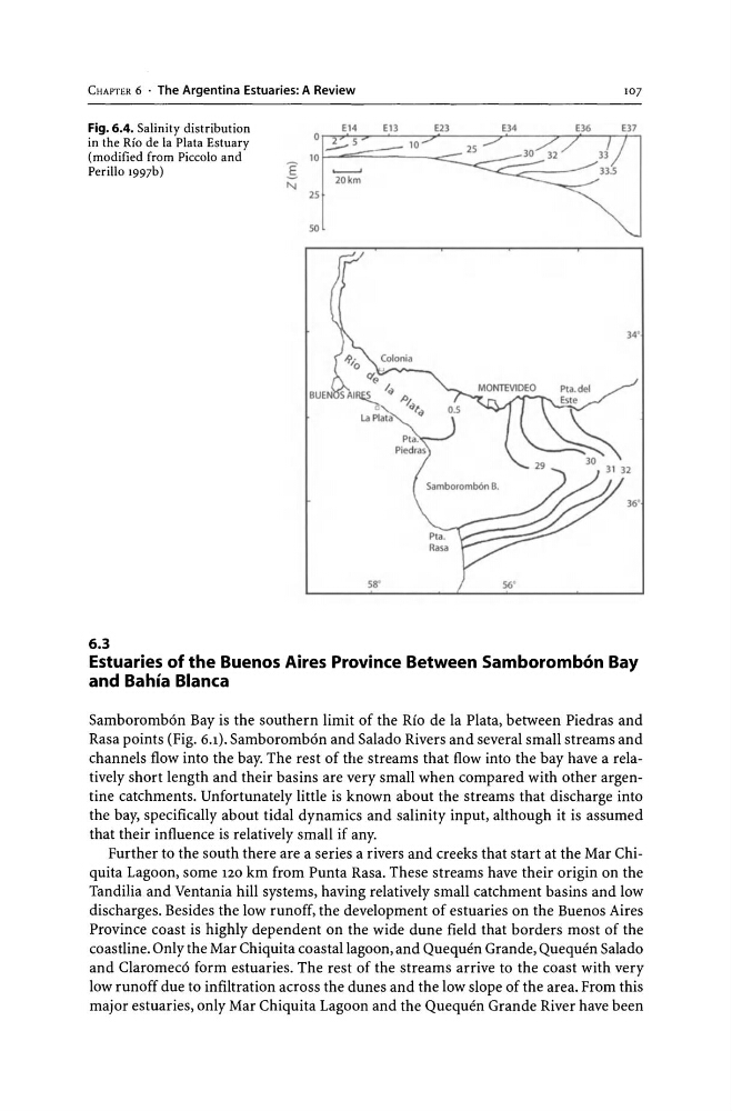
Fig. 6.4. Salinity distribution
in the Rio de la Plata Estuary
(modified from Piccolo and
Perillo 1997b)
o ___ 5
25
10 I--===-----<::::::~ _25
50
6.3
'-----'
20km
58'
56'
107
Estuaries of the Buenos Aires Province Between Samboromb6n Bay
and Bahia Blanca
Samboromb6n Bay is the southern limit of the Rio de la Plata, between Piedras and
Rasa points (Fig. 6.1). Samboromb6n and Salado Rivers and several small streams and
channels flow into the bay. The rest of the streams that flow into the bay have a relatively short length and their basins are very small when compared with other argentine catchments. Unfortunately little is known about the streams that discharge into
the bay, specifically about tidal dynamics and salinity input, although it is assumed
that their influence is relatively small if any.
Further to the south there are a series a rivers and creeks that start at the Mar Chiquita Lagoon, some 120 km from Punta Rasa. These streams have their origin on the
Tandilia and Ventania hill systems, having relatively small catchment basins and low
discharges. Besides the low runoff, the development of estuaries on the Buenos Aires
Province coast is highly dependent on the wide dune field that borders most of the
coastline. Only the Mar Chiquita coastal lagoon, and Quequen Grande, Quequen Salado
and Claromec6 form estuaries. The rest of the streams arrive to the coast with very
low runoff due to infiltration across the dunes and the low slope of the area. From this
major estuaries, only Mar Chiquita Lagoon and the Quequen Grande River have been
E14
Ell
En
E34
10
Fig. 6.4. Salinity distribution
in the Rio de la Plata Estuary
(modified from Piccolo and
Perillo 1997b)
o ___ 5
25
10 I--===-----<::::::~ _25
50
6.3
'-----'
20km
58'
56'
107
Estuaries of the Buenos Aires Province Between Samboromb6n Bay
and Bahia Blanca
Samboromb6n Bay is the southern limit of the Rio de la Plata, between Piedras and
Rasa points (Fig. 6.1). Samboromb6n and Salado Rivers and several small streams and
channels flow into the bay. The rest of the streams that flow into the bay have a relatively short length and their basins are very small when compared with other argentine catchments. Unfortunately little is known about the streams that discharge into
the bay, specifically about tidal dynamics and salinity input, although it is assumed
that their influence is relatively small if any.
Further to the south there are a series a rivers and creeks that start at the Mar Chiquita Lagoon, some 120 km from Punta Rasa. These streams have their origin on the
Tandilia and Ventania hill systems, having relatively small catchment basins and low
discharges. Besides the low runoff, the development of estuaries on the Buenos Aires
Province coast is highly dependent on the wide dune field that borders most of the
coastline. Only the Mar Chiquita coastal lagoon, and Quequen Grande, Quequen Salado
and Claromec6 form estuaries. The rest of the streams arrive to the coast with very
low runoff due to infiltration across the dunes and the low slope of the area. From this
major estuaries, only Mar Chiquita Lagoon and the Quequen Grande River have been