

WORLD ATLAS OF CORAL REEFS
«.^^
'''*^•=^^^"'~f:^-1i^^l£^2'r4
,
level. This is exemplified by the early work of Agassiz and
the later studies such as those carried out on the Great
Barrier Reef Expedition of 1928-29 and the works
supported by the Coral Atoll Program of the Pacific
Science Board. More recently, the mapping of individual
reefs and those of particular areas and countries at higher
resolution has developed considerably, though at widely
differing rates, throughout the world. In addition to charts,
reefs are increasingly shown on topographic maps, as well
as on other more specialized maps of natural resources.
The availability of remote sensing technology has greatly
improved the information base for reef mapping and this,
together with other techniques used in the preparation of
detailed reef maps, is considered in the next section.
I. Barbude
SfOiri^tophe.
')SZJ£ontseprat
i.delaGuadeloupe'
PETITE^
lies Sous I e Vent
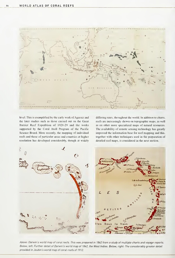
Above: Darwin 's world map of coral reefs. This was prepared in 1842 from a study of multiple cfiarts and voyage reports.
Below, left: Furttier detail of Darwin 's world map of 1842, the West Indies. Below, right: The considerably greater detail
provided in Joubin's world map of coral reefs of 1912.
«.^^
'''*^•=^^^"'~f:^-1i^^l£^2'r4
,
level. This is exemplified by the early work of Agassiz and
the later studies such as those carried out on the Great
Barrier Reef Expedition of 1928-29 and the works
supported by the Coral Atoll Program of the Pacific
Science Board. More recently, the mapping of individual
reefs and those of particular areas and countries at higher
resolution has developed considerably, though at widely
differing rates, throughout the world. In addition to charts,
reefs are increasingly shown on topographic maps, as well
as on other more specialized maps of natural resources.
The availability of remote sensing technology has greatly
improved the information base for reef mapping and this,
together with other techniques used in the preparation of
detailed reef maps, is considered in the next section.
I. Barbude
SfOiri^tophe.
')SZJ£ontseprat
i.delaGuadeloupe'
PETITE^
lies Sous I e Vent
Above: Darwin 's world map of coral reefs. This was prepared in 1842 from a study of multiple cfiarts and voyage reports.
Below, left: Furttier detail of Darwin 's world map of 1842, the West Indies. Below, right: The considerably greater detail
provided in Joubin's world map of coral reefs of 1912.