

Signs of Change
65
to assess reef health using standard procedures across
hundreds of coral reefs worldwide. At the same time, the
efforts of ReefCheck's partner organization, the Global
Coral Reef Monitoring Network, have led to regular
reporting by national experts enabling a parallel overview
based on expert opinion. Even with these systems,
however, the possibilities of looking at reefs and assessing
stress are limited - the majority are only visited by experts
every few years, and many have never been studied.
Reefs at risk
One alternative approach to mapping reef stress is to
model the threats to reefs using existing datasets,
combined with expert knowledge on the sensitivities of
reef ecosystems. In an attempt to undertake such an
objective global assessment, in 1998 the World Resources
Institute led a team of organizations and experts to
construct a global model of the different threats to reefs.
Data were not available to analyze all the major potential human impacts, so the model ignored both climate
change and direct physical destruction and concentrated
on what are currently the most widespread and potent
threats - pollution, sedimentation and unsustainable
fishing practices. For these, a number of proxy indicators
were utilized, enabling the development of four main
threat layers.
Coastal development (representing the primary
source of nutrient pollution, but also a source of
sedimentation): reefs were considered to be threatened by
a simple proximity measure for population centers of
varying size, airports, military bases, mmes and tourist
centers. An estimate of sewage treatment levels was also
factored into this layer.
Marine pollution (representing a secondary source
of mostly toxic pollutants): reefs were considered to be
threatened according to proximity to major ports, oil tanks
and wells, and major shipping routes.
Overexploitation and destructive fishing: the degree
to which reefs were considered threatened was based on
their proximity to differing levels of population density.
Known incidents of destructive fishing were further
buffered out as a potential threat to the wider reef
areas nearby.
Inland pollution and erosion (representing the
primary source of sedimenl mipacts, but also the important
pollutants associated with inland and agricultural areas): a
detailed surface model of "relative erosion potential" was
developed based on land cover, slope and rainfall. This was
modelled through the drainage basins to give a measure of
threat at river mouths, which was then buffered to nearby
reefs, the distance depending on intensity of input.
Usmg an earlier version of the reef maps presented
in this atlas, these threat layers were combined. After a
number of expert consultations, the refined model produced
a global map (see Map 2.4). It was estimated that, overall,
some 58 percent of the world's reefs were under medium to
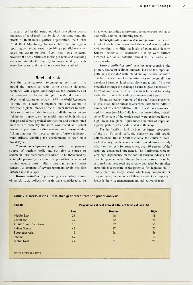
high threat. The global figure hides a number of important
regional patterns clearly illustrated in the map.
For the Pacific, which harbors the largest proportion
of the world's coral reefs, the majority are still largely
unthreatened. But in Southeast Asia, the center of coral
reef diversity, with many coastal populations heavily
reliant on the reefs for sustenance, over 80 percent of the
reefs are considered threatened. The Caribbean, with its
very high dependence on the coastal tourism industry, has
over 60 percent under threat. In some cases it can be
assumed that these reefs are already degraded, but in other
areas this is a measure of the potential for degradation. In
reality there are many factors which may compound, or
may mitigate, the outcome of these threats. One important
factor is the wise management and utilization of reefs.
Table 2.3: Reefs at risk Statistics genera ed from the global analysis
Region
Low
Proport ons of reef area at different levels of risk (%l
Medium
High
!
Middle East
39
Ub
15
Caribbean
39
32
29
Atlantic lexcl. Caribbean]
13
32
55
Indian Ocean
46
29
25
Southeast Asia
18
26
56
Pacific
59
31
10
Global total
42
31
27
Source: Bryant et al 119981.
65
to assess reef health using standard procedures across
hundreds of coral reefs worldwide. At the same time, the
efforts of ReefCheck's partner organization, the Global
Coral Reef Monitoring Network, have led to regular
reporting by national experts enabling a parallel overview
based on expert opinion. Even with these systems,
however, the possibilities of looking at reefs and assessing
stress are limited - the majority are only visited by experts
every few years, and many have never been studied.
Reefs at risk
One alternative approach to mapping reef stress is to
model the threats to reefs using existing datasets,
combined with expert knowledge on the sensitivities of
reef ecosystems. In an attempt to undertake such an
objective global assessment, in 1998 the World Resources
Institute led a team of organizations and experts to
construct a global model of the different threats to reefs.
Data were not available to analyze all the major potential human impacts, so the model ignored both climate
change and direct physical destruction and concentrated
on what are currently the most widespread and potent
threats - pollution, sedimentation and unsustainable
fishing practices. For these, a number of proxy indicators
were utilized, enabling the development of four main
threat layers.
Coastal development (representing the primary
source of nutrient pollution, but also a source of
sedimentation): reefs were considered to be threatened by
a simple proximity measure for population centers of
varying size, airports, military bases, mmes and tourist
centers. An estimate of sewage treatment levels was also
factored into this layer.
Marine pollution (representing a secondary source
of mostly toxic pollutants): reefs were considered to be
threatened according to proximity to major ports, oil tanks
and wells, and major shipping routes.
Overexploitation and destructive fishing: the degree
to which reefs were considered threatened was based on
their proximity to differing levels of population density.
Known incidents of destructive fishing were further
buffered out as a potential threat to the wider reef
areas nearby.
Inland pollution and erosion (representing the
primary source of sedimenl mipacts, but also the important
pollutants associated with inland and agricultural areas): a
detailed surface model of "relative erosion potential" was
developed based on land cover, slope and rainfall. This was
modelled through the drainage basins to give a measure of
threat at river mouths, which was then buffered to nearby
reefs, the distance depending on intensity of input.
Usmg an earlier version of the reef maps presented
in this atlas, these threat layers were combined. After a
number of expert consultations, the refined model produced
a global map (see Map 2.4). It was estimated that, overall,
some 58 percent of the world's reefs were under medium to
high threat. The global figure hides a number of important
regional patterns clearly illustrated in the map.
For the Pacific, which harbors the largest proportion
of the world's coral reefs, the majority are still largely
unthreatened. But in Southeast Asia, the center of coral
reef diversity, with many coastal populations heavily
reliant on the reefs for sustenance, over 80 percent of the
reefs are considered threatened. The Caribbean, with its
very high dependence on the coastal tourism industry, has
over 60 percent under threat. In some cases it can be
assumed that these reefs are already degraded, but in other
areas this is a measure of the potential for degradation. In
reality there are many factors which may compound, or
may mitigate, the outcome of these threats. One important
factor is the wise management and utilization of reefs.
Table 2.3: Reefs at risk Statistics genera ed from the global analysis
Region
Low
Proport ons of reef area at different levels of risk (%l
Medium
High
!
Middle East
39
Ub
15
Caribbean
39
32
29
Atlantic lexcl. Caribbean]
13
32
55
Indian Ocean
46
29
25
Southeast Asia
18
26
56
Pacific
59
31
10
Global total
42
31
27
Source: Bryant et al 119981.