

386
E. Taira
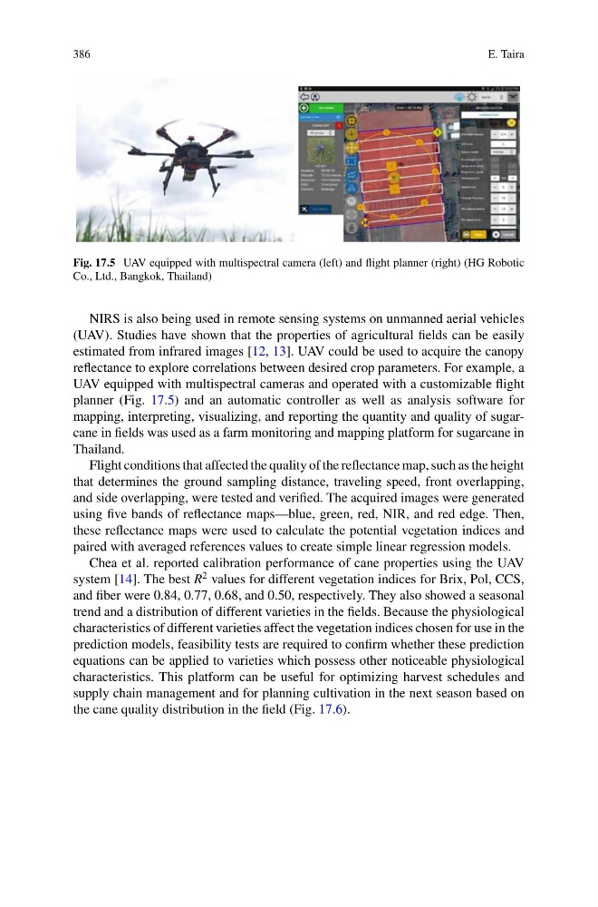
Fig. 17.5 UAV equipped with multispectral camera (left) and flight planner (right) (HG Robotic
Co., Ltd., Bangkok, Thailand)
NIRS is also being used in remote sensing systems on unmanned aerial vehicles
(UAV). Studies have shown that the properties of agricultural fields can be easily
estimated from infrared images [12, 13]. UAV could be used to acquire the canopy
reflectance to explore correlations between desired crop parameters. For example, a
UAV equipped with multispectral cameras and operated with a customizable flight
planner (Fig. 17.5) and an automatic controller as well as analysis software for
mapping, interpreting, visualizing, and reporting the quantity and quality of sugarcane in fields was used as a farm monitoring and mapping platform for sugarcane in
Thailand.
Flight conditions that affected the quality of the reflectance map, such as the height
that determines the ground sampling distance, traveling speed, front overlapping,
and side overlapping, were tested and verified. The acquired images were generated
using five bands of reflectance maps—blue, green, red, NIR, and red edge. Then,
these reflectance maps were used to calculate the potential vegetation indices and
paired with averaged references values to create simple linear regression models.
Chea et al. reported calibration performance of cane properties using the UAV
system [14]. The best R
2 values for different vegetation indices for Brix, Pol, CCS,
and fiber were 0.84, 0.77, 0.68, and 0.50, respectively. They also showed a seasonal
trend and a distribution of different varieties in the fields. Because the physiological
characteristics of different varieties affect the vegetation indices chosen for use in the
prediction models, feasibility tests are required to confirm whether these prediction
equations can be applied to varieties which possess other noticeable physiological
characteristics. This platform can be useful for optimizing harvest schedules and
supply chain management and for planning cultivation in the next season based on
the cane quality distribution in the field (Fig. 17.6).
E. Taira
Fig. 17.5 UAV equipped with multispectral camera (left) and flight planner (right) (HG Robotic
Co., Ltd., Bangkok, Thailand)
NIRS is also being used in remote sensing systems on unmanned aerial vehicles
(UAV). Studies have shown that the properties of agricultural fields can be easily
estimated from infrared images [12, 13]. UAV could be used to acquire the canopy
reflectance to explore correlations between desired crop parameters. For example, a
UAV equipped with multispectral cameras and operated with a customizable flight
planner (Fig. 17.5) and an automatic controller as well as analysis software for
mapping, interpreting, visualizing, and reporting the quantity and quality of sugarcane in fields was used as a farm monitoring and mapping platform for sugarcane in
Thailand.
Flight conditions that affected the quality of the reflectance map, such as the height
that determines the ground sampling distance, traveling speed, front overlapping,
and side overlapping, were tested and verified. The acquired images were generated
using five bands of reflectance maps—blue, green, red, NIR, and red edge. Then,
these reflectance maps were used to calculate the potential vegetation indices and
paired with averaged references values to create simple linear regression models.
Chea et al. reported calibration performance of cane properties using the UAV
system [14]. The best R
2 values for different vegetation indices for Brix, Pol, CCS,
and fiber were 0.84, 0.77, 0.68, and 0.50, respectively. They also showed a seasonal
trend and a distribution of different varieties in the fields. Because the physiological
characteristics of different varieties affect the vegetation indices chosen for use in the
prediction models, feasibility tests are required to confirm whether these prediction
equations can be applied to varieties which possess other noticeable physiological
characteristics. This platform can be useful for optimizing harvest schedules and
supply chain management and for planning cultivation in the next season based on
the cane quality distribution in the field (Fig. 17.6).