

12 Radar Systems of Maritime Transport
223
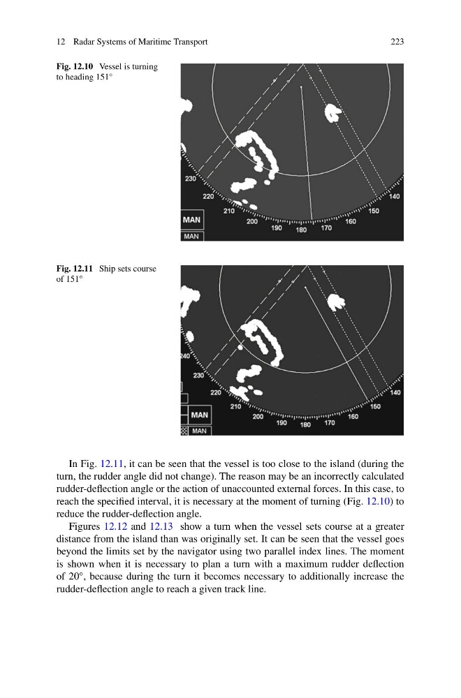
Fig. 12.10 Vessel is turning
to heading 151°
Fig. 12.11 Ship sets course
of 151°
In Fig. 12.11, it can be seen that the vessel is too close to the island (during the
turn, the rudder angle did not change). The reason may be an incorrectly calculated
rudder-deflection angle or the action of unaccounted external forces. In this case, to
reach the specified interval, it is necessary at the moment of turning (Fig. 12.10) to
reduce the rudder-deflection angle.
Figures 12.12 and 12.13 show a turn when the vessel sets course at a greater
distance from the island than was originally set. It can be seen that the vessel goes
beyond the limits set by the navigator using two parallel index lines. The moment
is shown when it is necessary to plan a turn with a maximum rudder deflection
of 20°, because during the turn it becomes necessary to additionally increase the
rudder-deflection angle to reach a given track line.
223
Fig. 12.10 Vessel is turning
to heading 151°
Fig. 12.11 Ship sets course
of 151°
In Fig. 12.11, it can be seen that the vessel is too close to the island (during the
turn, the rudder angle did not change). The reason may be an incorrectly calculated
rudder-deflection angle or the action of unaccounted external forces. In this case, to
reach the specified interval, it is necessary at the moment of turning (Fig. 12.10) to
reduce the rudder-deflection angle.
Figures 12.12 and 12.13 show a turn when the vessel sets course at a greater
distance from the island than was originally set. It can be seen that the vessel goes
beyond the limits set by the navigator using two parallel index lines. The moment
is shown when it is necessary to plan a turn with a maximum rudder deflection
of 20°, because during the turn it becomes necessary to additionally increase the
rudder-deflection angle to reach a given track line.