

190
J. Fluixá-Sanmartín et al.
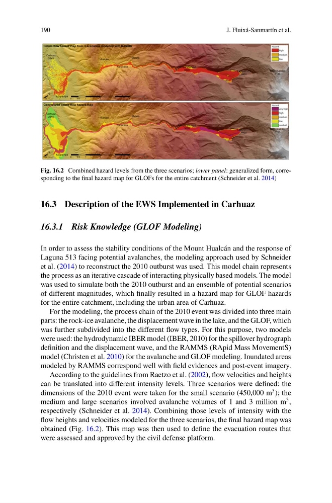
Fig. 16.2 Combined hazard levels from the three scenarios; lower panel: generalized form, corresponding to the final hazard map for GLOFs for the entire catchment (Schneider et al. 2014)
16.3 Description of the EWS Implemented in Carhuaz
16.3.1 Risk Knowledge (GLOF Modeling)
In order to assess the stability conditions of the Mount Hualcán and the response of
Laguna 513 facing potential avalanches, the modeling approach used by Schneider
et al. (2014) to reconstruct the 2010 outburst was used. This model chain represents
the process as an iterative cascade of interacting physically based models. The model
was used to simulate both the 2010 outburst and an ensemble of potential scenarios
of different magnitudes, which finally resulted in a hazard map for GLOF hazards
for the entire catchment, including the urban area of Carhuaz.
For the modeling, the process chain of the 2010 event was divided into three main
parts: the rock-ice avalanche, the displacement wave in the lake, and the GLOF, which
was further subdivided into the different flow types. For this purpose, two models
were used: the hydrodynamic IBER model (IBER, 2010) for the spillover hydrograph
definition and the displacement wave, and the RAMMS (RApid Mass MovementS)
model (Christen et al. 2010) for the avalanche and GLOF modeling. Inundated areas
modeled by RAMMS correspond well with field evidences and post-event imagery.
According to the guidelines from Raetzo et al. (2002), flow velocities and heights
can be translated into different intensity levels. Three scenarios were defined: the
dimensions of the 2010 event were taken for the small scenario (450,000 m
3 ); the
medium and large scenarios involved avalanche volumes of 1 and 3 million m
3 ,
respectively (Schneider et al. 2014). Combining those levels of intensity with the
flow heights and velocities modeled for the three scenarios, the final hazard map was
obtained (Fig. 16.2). This map was then used to define the evacuation routes that
were assessed and approved by the civil defense platform.
J. Fluixá-Sanmartín et al.
Fig. 16.2 Combined hazard levels from the three scenarios; lower panel: generalized form, corresponding to the final hazard map for GLOFs for the entire catchment (Schneider et al. 2014)
16.3 Description of the EWS Implemented in Carhuaz
16.3.1 Risk Knowledge (GLOF Modeling)
In order to assess the stability conditions of the Mount Hualcán and the response of
Laguna 513 facing potential avalanches, the modeling approach used by Schneider
et al. (2014) to reconstruct the 2010 outburst was used. This model chain represents
the process as an iterative cascade of interacting physically based models. The model
was used to simulate both the 2010 outburst and an ensemble of potential scenarios
of different magnitudes, which finally resulted in a hazard map for GLOF hazards
for the entire catchment, including the urban area of Carhuaz.
For the modeling, the process chain of the 2010 event was divided into three main
parts: the rock-ice avalanche, the displacement wave in the lake, and the GLOF, which
was further subdivided into the different flow types. For this purpose, two models
were used: the hydrodynamic IBER model (IBER, 2010) for the spillover hydrograph
definition and the displacement wave, and the RAMMS (RApid Mass MovementS)
model (Christen et al. 2010) for the avalanche and GLOF modeling. Inundated areas
modeled by RAMMS correspond well with field evidences and post-event imagery.
According to the guidelines from Raetzo et al. (2002), flow velocities and heights
can be translated into different intensity levels. Three scenarios were defined: the
dimensions of the 2010 event were taken for the small scenario (450,000 m
3 ); the
medium and large scenarios involved avalanche volumes of 1 and 3 million m
3 ,
respectively (Schneider et al. 2014). Combining those levels of intensity with the
flow heights and velocities modeled for the three scenarios, the final hazard map was
obtained (Fig. 16.2). This map was then used to define the evacuation routes that
were assessed and approved by the civil defense platform.