

Geomorphology of Dakhla Depression
61
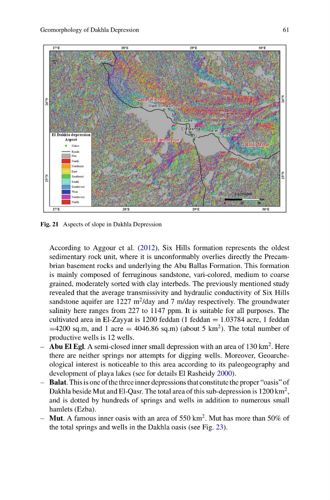
Fig. 21 Aspects of slope in Dakhla Depression
According to Aggour et al. (2012), Six Hills formation represents the oldest
sedimentary rock unit, where it is unconformably overlies directly the Precambrian basement rocks and underlying the Abu Ballas Formation. This formation
is mainly composed of ferruginous sandstone, vari-colored, medium to coarse
grained, moderately sorted with clay interbeds. The previously mentioned study
revealed that the average transmissivity and hydraulic conductivity of Six Hills
sandstone aquifer are 1227 m
2 /day and 7 m/day respectively. The groundwater
salinity here ranges from 227 to 1147 ppm. It is suitable for all purposes. The
cultivated area in El-Zayyat is 1200 feddan (1 feddan = 1.03784 acre, 1 feddan
=4200 sq.m, and 1 acre = 4046.86 sq.m) (about 5 km
2 ). The total number of
productive wells is 12 wells.
– Abu El Egl. A semi-closed inner small depression with an area of 130 km
2 . Here
there are neither springs nor attempts for digging wells. Moreover, Geoarcheological interest is noticeable to this area according to its paleogeography and
development of playa lakes (see for details El Rasheidy 2000).
– Balat. This is one of the three inner depressions that constitute the proper “oasis” of
Dakhla beside Mut and El-Qasr. The total area of this sub-depression is 1200 km
2 ,
and is dotted by hundreds of springs and wells in addition to numerous small
hamlets (Ezba).
– Mut. A famous inner oasis with an area of 550 km
2 . Mut has more than 50% of
the total springs and wells in the Dakhla oasis (see Fig. 23).
61
Fig. 21 Aspects of slope in Dakhla Depression
According to Aggour et al. (2012), Six Hills formation represents the oldest
sedimentary rock unit, where it is unconformably overlies directly the Precambrian basement rocks and underlying the Abu Ballas Formation. This formation
is mainly composed of ferruginous sandstone, vari-colored, medium to coarse
grained, moderately sorted with clay interbeds. The previously mentioned study
revealed that the average transmissivity and hydraulic conductivity of Six Hills
sandstone aquifer are 1227 m
2 /day and 7 m/day respectively. The groundwater
salinity here ranges from 227 to 1147 ppm. It is suitable for all purposes. The
cultivated area in El-Zayyat is 1200 feddan (1 feddan = 1.03784 acre, 1 feddan
=4200 sq.m, and 1 acre = 4046.86 sq.m) (about 5 km
2 ). The total number of
productive wells is 12 wells.
– Abu El Egl. A semi-closed inner small depression with an area of 130 km
2 . Here
there are neither springs nor attempts for digging wells. Moreover, Geoarcheological interest is noticeable to this area according to its paleogeography and
development of playa lakes (see for details El Rasheidy 2000).
– Balat. This is one of the three inner depressions that constitute the proper “oasis” of
Dakhla beside Mut and El-Qasr. The total area of this sub-depression is 1200 km
2 ,
and is dotted by hundreds of springs and wells in addition to numerous small
hamlets (Ezba).
– Mut. A famous inner oasis with an area of 550 km
2 . Mut has more than 50% of
the total springs and wells in the Dakhla oasis (see Fig. 23).