

62
A. M. A. Mohamed
– El Qasr. This western sub-oasis has a total area of 765 km
2 . While the rest of
sub depressions orients East–West, El Qasr area extends from north to south,
where the town of El Qasr lies very near to the scarp in the north and the town of
E-Qalamoun lies in the south.
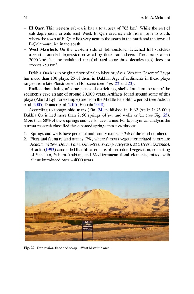
– West Mawhub. On the western side of Edmonstone, detached hill stretches
a semi—rounded depression covered by thick sand sheets. The area is about
2000 km
2 , but the reclaimed area (initiated some three decades ago) does not
exceed 250 km
2 .
Dakhla Oasis is in origin a floor of paleo lakes or playa. Western Desert of Egypt
has more than 100 plays, 25 of them in Dakhla. Age of sediments in these playa
ranges from late Pleistocene to Holocene (see Figs. 22 and 23).
Radiocarbon dating of some pieces of ostrich egg-shells found on the top of the
sediments gave an age of around 20,000 years. Artifacts found around some of this
playa (Abu El Egl, for example) are from the Middle Paleolithic period (see Ashour
et al. 2005; Donner et al. 2015; Embabi 2018).
According to topographic maps (Fig. 24) published in 1932 (scale 1: 25.000)
Dakhla Oasis had more than 2150 springs (A’yn) and wells or bir (see Fig. 25).
More than 60% of these springs and wells have names. For toponymical analysis the
current research classified these named springs into five classes:
1. Springs and wells have personal and family names (43% of the total number).
2. Flora and fauna related names (7%) where famous vegetation related names are
Acacia, Willow, Doum Palm, Olive-tree, swamp sawgrass, and Heesh (Arundo).
Brooks (1993) concluded that little remains of the natural vegetation, consisting
of Sahelian, Sahara-Arabian, and Mediterranean floral elements, mixed with
aliens introduced over −4000 years.
Fig. 22 Depression floor and scarp—West Mawhub area
A. M. A. Mohamed
– El Qasr. This western sub-oasis has a total area of 765 km
2 . While the rest of
sub depressions orients East–West, El Qasr area extends from north to south,
where the town of El Qasr lies very near to the scarp in the north and the town of
E-Qalamoun lies in the south.
– West Mawhub. On the western side of Edmonstone, detached hill stretches
a semi—rounded depression covered by thick sand sheets. The area is about
2000 km
2 , but the reclaimed area (initiated some three decades ago) does not
exceed 250 km
2 .
Dakhla Oasis is in origin a floor of paleo lakes or playa. Western Desert of Egypt
has more than 100 plays, 25 of them in Dakhla. Age of sediments in these playa
ranges from late Pleistocene to Holocene (see Figs. 22 and 23).
Radiocarbon dating of some pieces of ostrich egg-shells found on the top of the
sediments gave an age of around 20,000 years. Artifacts found around some of this
playa (Abu El Egl, for example) are from the Middle Paleolithic period (see Ashour
et al. 2005; Donner et al. 2015; Embabi 2018).
According to topographic maps (Fig. 24) published in 1932 (scale 1: 25.000)
Dakhla Oasis had more than 2150 springs (A’yn) and wells or bir (see Fig. 25).
More than 60% of these springs and wells have names. For toponymical analysis the
current research classified these named springs into five classes:
1. Springs and wells have personal and family names (43% of the total number).
2. Flora and fauna related names (7%) where famous vegetation related names are
Acacia, Willow, Doum Palm, Olive-tree, swamp sawgrass, and Heesh (Arundo).
Brooks (1993) concluded that little remains of the natural vegetation, consisting
of Sahelian, Sahara-Arabian, and Mediterranean floral elements, mixed with
aliens introduced over −4000 years.
Fig. 22 Depression floor and scarp—West Mawhub area