

Development of Land Use and Groundwater …
227
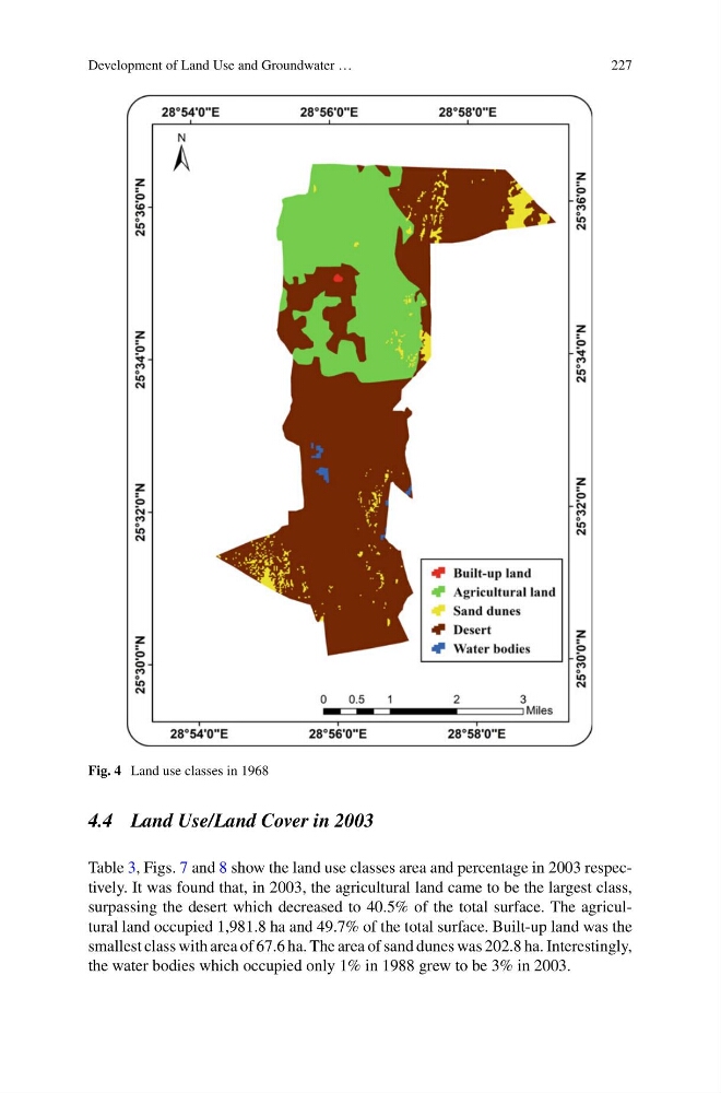
Fig. 4 Land use classes in 1968
4.4 Land Use/Land Cover in 2003
Table 3, Figs. 7 and 8 show the land use classes area and percentage in 2003 respectively. It was found that, in 2003, the agricultural land came to be the largest class,
surpassing the desert which decreased to 40.5% of the total surface. The agricultural land occupied 1,981.8 ha and 49.7% of the total surface. Built-up land was the
smallest class with area of 67.6 ha. The area of sand dunes was 202.8 ha. Interestingly,
the water bodies which occupied only 1% in 1988 grew to be 3% in 2003.
227
Fig. 4 Land use classes in 1968
4.4 Land Use/Land Cover in 2003
Table 3, Figs. 7 and 8 show the land use classes area and percentage in 2003 respectively. It was found that, in 2003, the agricultural land came to be the largest class,
surpassing the desert which decreased to 40.5% of the total surface. The agricultural land occupied 1,981.8 ha and 49.7% of the total surface. Built-up land was the
smallest class with area of 67.6 ha. The area of sand dunes was 202.8 ha. Interestingly,
the water bodies which occupied only 1% in 1988 grew to be 3% in 2003.