

226
E. Iwasaki et al.
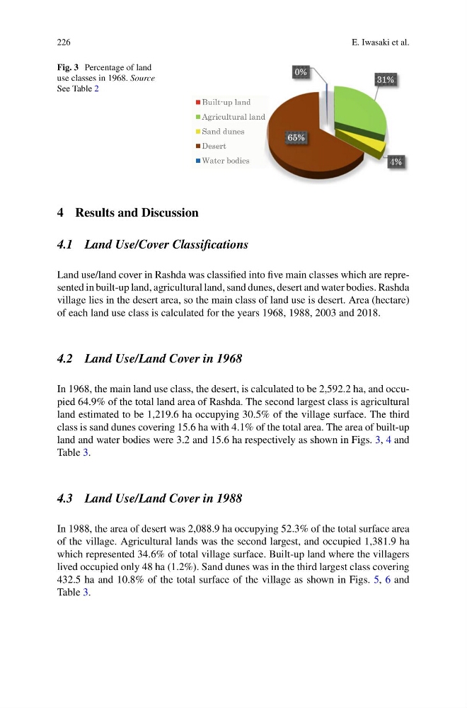
Fig. 3 Percentage of land
use classes in 1968. Source
See Table 2
31%
4%
65%
0%
Built-up land
Agricultural land
Sand dunes
Desert
Water bodies
4 Results and Discussion
4.1 Land Use/Cover Classifications
Land use/land cover in Rashda was classified into five main classes which are represented in built-up land, agricultural land, sand dunes, desert and water bodies. Rashda
village lies in the desert area, so the main class of land use is desert. Area (hectare)
of each land use class is calculated for the years 1968, 1988, 2003 and 2018.
4.2 Land Use/Land Cover in 1968
In 1968, the main land use class, the desert, is calculated to be 2,592.2 ha, and occupied 64.9% of the total land area of Rashda. The second largest class is agricultural
land estimated to be 1,219.6 ha occupying 30.5% of the village surface. The third
class is sand dunes covering 15.6 ha with 4.1% of the total area. The area of built-up
land and water bodies were 3.2 and 15.6 ha respectively as shown in Figs. 3, 4 and
Table 3.
4.3 Land Use/Land Cover in 1988
In 1988, the area of desert was 2,088.9 ha occupying 52.3% of the total surface area
of the village. Agricultural lands was the second largest, and occupied 1,381.9 ha
which represented 34.6% of total village surface. Built-up land where the villagers
lived occupied only 48 ha (1.2%). Sand dunes was in the third largest class covering
432.5 ha and 10.8% of the total surface of the village as shown in Figs. 5, 6 and
Table 3.
E. Iwasaki et al.
Fig. 3 Percentage of land
use classes in 1968. Source
See Table 2
31%
4%
65%
0%
Built-up land
Agricultural land
Sand dunes
Desert
Water bodies
4 Results and Discussion
4.1 Land Use/Cover Classifications
Land use/land cover in Rashda was classified into five main classes which are represented in built-up land, agricultural land, sand dunes, desert and water bodies. Rashda
village lies in the desert area, so the main class of land use is desert. Area (hectare)
of each land use class is calculated for the years 1968, 1988, 2003 and 2018.
4.2 Land Use/Land Cover in 1968
In 1968, the main land use class, the desert, is calculated to be 2,592.2 ha, and occupied 64.9% of the total land area of Rashda. The second largest class is agricultural
land estimated to be 1,219.6 ha occupying 30.5% of the village surface. The third
class is sand dunes covering 15.6 ha with 4.1% of the total area. The area of built-up
land and water bodies were 3.2 and 15.6 ha respectively as shown in Figs. 3, 4 and
Table 3.
4.3 Land Use/Land Cover in 1988
In 1988, the area of desert was 2,088.9 ha occupying 52.3% of the total surface area
of the village. Agricultural lands was the second largest, and occupied 1,381.9 ha
which represented 34.6% of total village surface. Built-up land where the villagers
lived occupied only 48 ha (1.2%). Sand dunes was in the third largest class covering
432.5 ha and 10.8% of the total surface of the village as shown in Figs. 5, 6 and
Table 3.