

Remote Sensing and GIS for Land Use …
157
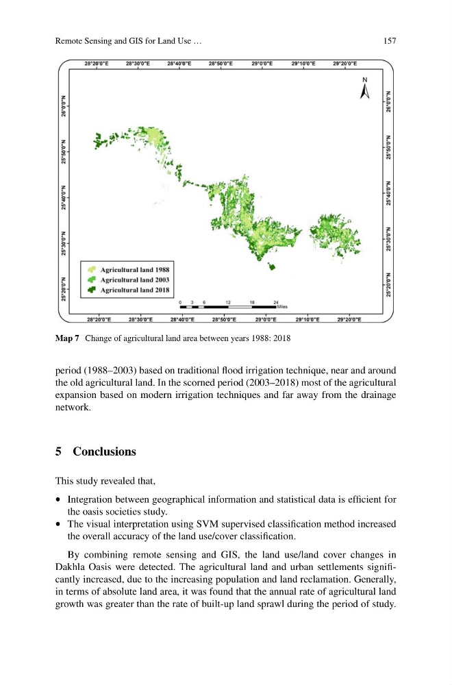
Map 7 Change of agricultural land area between years 1988: 2018
period (1988–2003) based on traditional flood irrigation technique, near and around
the old agricultural land. In the scorned period (2003–2018) most of the agricultural
expansion based on modern irrigation techniques and far away from the drainage
network.
5 Conclusions
This study revealed that,
• Integration between geographical information and statistical data is efficient for
the oasis societies study.
• The visual interpretation using SVM supervised classification method increased
the overall accuracy of the land use/cover classification.
By combining remote sensing and GIS, the land use/land cover changes in
Dakhla Oasis were detected. The agricultural land and urban settlements significantly increased, due to the increasing population and land reclamation. Generally,
in terms of absolute land area, it was found that the annual rate of agricultural land
growth was greater than the rate of built-up land sprawl during the period of study.
157
Map 7 Change of agricultural land area between years 1988: 2018
period (1988–2003) based on traditional flood irrigation technique, near and around
the old agricultural land. In the scorned period (2003–2018) most of the agricultural
expansion based on modern irrigation techniques and far away from the drainage
network.
5 Conclusions
This study revealed that,
• Integration between geographical information and statistical data is efficient for
the oasis societies study.
• The visual interpretation using SVM supervised classification method increased
the overall accuracy of the land use/cover classification.
By combining remote sensing and GIS, the land use/land cover changes in
Dakhla Oasis were detected. The agricultural land and urban settlements significantly increased, due to the increasing population and land reclamation. Generally,
in terms of absolute land area, it was found that the annual rate of agricultural land
growth was greater than the rate of built-up land sprawl during the period of study.