

Soil Conditions of Dakhla Oasis, Western Desert, Egypt
127
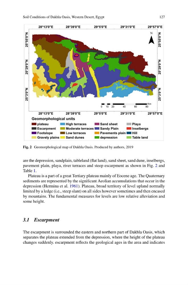
Fig. 2 Geomorphological map of Dakhla Oasis. Produced by authors, 2019
are the depression, sandplain, tableland (flat land), sand sheet, sand dune, inselbergs,
pavement plain, playa, river terraces and steep escarpment as shown in Fig. 2 and
Table 1.
Plateau is a part of a great Tertiary plateau mainly of Eocene age. The Quaternary
sediments are represented by the significant Aeolian accumulations that occur in the
depression (Hermina et al. 1961). Plateau, broad territory of level upland normally
limited by a ledge (i.e., steep slant) on all sides however sometimes and then encased
by mountains. The fundamental measures for levels are low relative alleviation and
some height.
3.1 Escarpment
The escarpment is surrounded the eastern and northern part of Dakhla Oasis, which
separates the plateau extended from the depression, where the height of the plateau
changes suddenly. escarpment reflects the geological ages in the area and indicates
127
Fig. 2 Geomorphological map of Dakhla Oasis. Produced by authors, 2019
are the depression, sandplain, tableland (flat land), sand sheet, sand dune, inselbergs,
pavement plain, playa, river terraces and steep escarpment as shown in Fig. 2 and
Table 1.
Plateau is a part of a great Tertiary plateau mainly of Eocene age. The Quaternary
sediments are represented by the significant Aeolian accumulations that occur in the
depression (Hermina et al. 1961). Plateau, broad territory of level upland normally
limited by a ledge (i.e., steep slant) on all sides however sometimes and then encased
by mountains. The fundamental measures for levels are low relative alleviation and
some height.
3.1 Escarpment
The escarpment is surrounded the eastern and northern part of Dakhla Oasis, which
separates the plateau extended from the depression, where the height of the plateau
changes suddenly. escarpment reflects the geological ages in the area and indicates