

118
K. Shrestha et al.
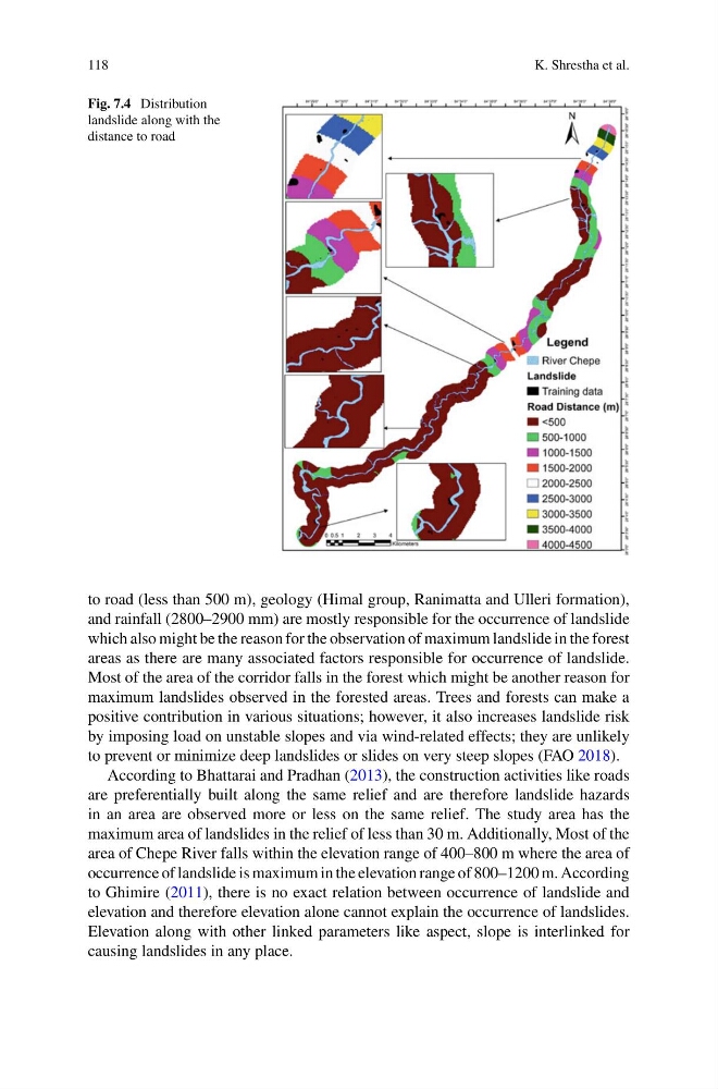
Fig. 7.4 Distribution
landslide along with the
distance to road
to road (less than 500 m), geology (Himal group, Ranimatta and Ulleri formation),
and rainfall (2800–2900 mm) are mostly responsible for the occurrence of landslide
which also might be the reason for the observation of maximum landslide in the forest
areas as there are many associated factors responsible for occurrence of landslide.
Most of the area of the corridor falls in the forest which might be another reason for
maximum landslides observed in the forested areas. Trees and forests can make a
positive contribution in various situations; however, it also increases landslide risk
by imposing load on unstable slopes and via wind-related effects; they are unlikely
to prevent or minimize deep landslides or slides on very steep slopes (FAO 2018).
According to Bhattarai and Pradhan (2013), the construction activities like roads
are preferentially built along the same relief and are therefore landslide hazards
in an area are observed more or less on the same relief. The study area has the
maximum area of landslides in the relief of less than 30 m. Additionally, Most of the
area of Chepe River falls within the elevation range of 400–800 m where the area of
occurrence of landslide is maximum in the elevation range of 800–1200 m. According
to Ghimire (2011), there is no exact relation between occurrence of landslide and
elevation and therefore elevation alone cannot explain the occurrence of landslides.
Elevation along with other linked parameters like aspect, slope is interlinked for
causing landslides in any place.
K. Shrestha et al.
Fig. 7.4 Distribution
landslide along with the
distance to road
to road (less than 500 m), geology (Himal group, Ranimatta and Ulleri formation),
and rainfall (2800–2900 mm) are mostly responsible for the occurrence of landslide
which also might be the reason for the observation of maximum landslide in the forest
areas as there are many associated factors responsible for occurrence of landslide.
Most of the area of the corridor falls in the forest which might be another reason for
maximum landslides observed in the forested areas. Trees and forests can make a
positive contribution in various situations; however, it also increases landslide risk
by imposing load on unstable slopes and via wind-related effects; they are unlikely
to prevent or minimize deep landslides or slides on very steep slopes (FAO 2018).
According to Bhattarai and Pradhan (2013), the construction activities like roads
are preferentially built along the same relief and are therefore landslide hazards
in an area are observed more or less on the same relief. The study area has the
maximum area of landslides in the relief of less than 30 m. Additionally, Most of the
area of Chepe River falls within the elevation range of 400–800 m where the area of
occurrence of landslide is maximum in the elevation range of 800–1200 m. According
to Ghimire (2011), there is no exact relation between occurrence of landslide and
elevation and therefore elevation alone cannot explain the occurrence of landslides.
Elevation along with other linked parameters like aspect, slope is interlinked for
causing landslides in any place.