

7 Comparative GIS-Based Assessment …
117
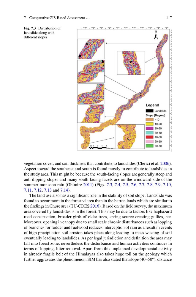
Fig. 7.3 Distribution of
landslide along with
different slopes
vegetation cover, and soil thickness that contribute to landslides (Clerici et al. 2006).
Aspect toward the southeast and south is found mostly to contribute to landslides in
the study area. This might be because the south-facing slopes are generally steep and
anti-dipping slopes and many south-facing facets are on the windward side of the
summer monsoon rain (Ghimire 2011) (Figs. 7.3, 7.4, 7.5, 7.6, 7.7, 7.8, 7.9, 7.10,
7.11, 7.12, 7.13 and 7.14).
The land use also has a significant role in the stability of soil slope. Landslide was
found to occur more in the forested area than in the barren lands which are similar to
the findings in Chure area (TU-CDES 2016). Based on the field survey, the maximum
area covered by landslides is in the forest. This may be due to factors like haphazard
road construction, broader girth of older trees, spring source creating gullies, etc.
Moreover, opening in canopy due to small scale chronic disturbances such as lopping
of branches for fodder and fuelwood reduces interception of rain as a result in events
of high precipitation soil erosion takes place along leading to mass wasting of soil
eventually leading to landslides. As per legal jurisdiction and definition the area may
fall into forest zone, nevertheless the disturbance and human activities continues in
terms of lopping, litter removal. Apart from this unplanned developmental activity
in already fragile belt of the Himalayas also takes huge toll on the geology which
further aggravates the phenomenon. SIM has also stated that slope (40–50°), distance
117
Fig. 7.3 Distribution of
landslide along with
different slopes
vegetation cover, and soil thickness that contribute to landslides (Clerici et al. 2006).
Aspect toward the southeast and south is found mostly to contribute to landslides in
the study area. This might be because the south-facing slopes are generally steep and
anti-dipping slopes and many south-facing facets are on the windward side of the
summer monsoon rain (Ghimire 2011) (Figs. 7.3, 7.4, 7.5, 7.6, 7.7, 7.8, 7.9, 7.10,
7.11, 7.12, 7.13 and 7.14).
The land use also has a significant role in the stability of soil slope. Landslide was
found to occur more in the forested area than in the barren lands which are similar to
the findings in Chure area (TU-CDES 2016). Based on the field survey, the maximum
area covered by landslides is in the forest. This may be due to factors like haphazard
road construction, broader girth of older trees, spring source creating gullies, etc.
Moreover, opening in canopy due to small scale chronic disturbances such as lopping
of branches for fodder and fuelwood reduces interception of rain as a result in events
of high precipitation soil erosion takes place along leading to mass wasting of soil
eventually leading to landslides. As per legal jurisdiction and definition the area may
fall into forest zone, nevertheless the disturbance and human activities continues in
terms of lopping, litter removal. Apart from this unplanned developmental activity
in already fragile belt of the Himalayas also takes huge toll on the geology which
further aggravates the phenomenon. SIM has also stated that slope (40–50°), distance